
Road Occupancy Permit Mississauga
A road occupancy permit in Mississauga addresses work in the City’s right-of-way, not just the service design on private property. For Mississauga service connections involving water, sanitary or storm systems, owners need to distinguish the accepted drawings, the relevant connection records and the municipal permission to occupy public space. This guide explains the civil-design interfaces and application information without replacing the City’s requirements or a contractor’s responsibilities.

What a Mississauga road occupancy permit authorizes
A road occupancy permit in Mississauga addresses the use of the City’s right-of-way for the work described in the permit. For a service connection, that means treating the public-road interface as a separate approval question. A drawing approved for a private property does not, by itself, answer whether the proposed work may occupy a municipal road, sidewalk or boulevard.
This guide focuses on service connections and disconnections. It does not provide instructions for excavation, traffic control or utility installation. Instead, it explains how an owner and their appointed professionals can organize the design information that connects the property, the servicing authority and the municipal permit application.
The useful starting question is not simply, “Do we have an approval?” Ask which document authorizes which part of the proposal, who issued it, and whether its drawing references still match the intended work. That distinction helps expose missing dependencies before a contractor is expected to act on an incomplete package.
Keep the permit boundary separate from the property boundary
A property line is a physical and legal reference on the drawing. An approval boundary describes the scope covered by a particular document. These boundaries may interact, but they are not interchangeable. A service can begin on private land and continue into the public right-of-way while remaining subject to different review responsibilities.
Show that transition clearly in the project information. Identify the private-site drawing, the proposed connection location and the relevant public infrastructure. Where the source information is uncertain, identify the uncertainty rather than drawing a confident line that conceals it. The responsible designer must decide what further information the assignment requires.
Do not confuse a road occupancy permit with a construction method
A permit application describes proposed work and its effects. It does not replace the contractor’s responsibilities for execution or the separate professional assignments needed for specialized work. Similarly, a civil design drawing is not automatically a traffic-management plan, a shoring design or a safe excavation procedure.
The owner should know which parties are responsible for each part of the package. If a task is outside the civil consultant’s agreed scope, name the dependency early. This is more useful than assuming that a general phrase such as “complete permit package” includes every discipline or construction activity.
Three separate questions: Is the proposed service design acceptable? Is the necessary right-of-way permission in place? Are the appointed parties ready to carry out their own responsibilities? One affirmative answer does not establish all three.
Choose the correct service connection permit route
Mississauga’s road occupancy permit guidance distinguishes service connections from other kinds of road occupation. For the service-connection route, a storm connection needs the City’s approved storm-connection letter. Water or sanitary connections need a Peel C-receipt and matching approved drawings. The page also identifies a separate requirement for secondary hydro connections.
This article’s engineering discussion concerns water, sanitary and storm servicing coordination. It does not imply that Elmid Design Inc. provides electrical utility design. If the proposed work includes another utility, the owner should obtain direction from that utility and the appropriately appointed professional.
Recognize when a lateral connection becomes a different proposal
The City’s service-connection route is not the route for a mainline extension. Its service-connection checklist directs different infrastructure work to other processes. Therefore, confirm the nature of the proposal before assembling a package around the wrong application type.
In practical terms, do not decide the route solely from a project’s marketing description. A small redevelopment can still have a complex servicing interface. Conversely, a substantial private project may involve a narrowly defined connection. The actual infrastructure proposal, not the size of the building alone, should frame the discussion with the reviewing authority.
Separate new connections, disconnections and changes to existing services
Start with an accurate description of what will remain, what will be removed from service and what will be introduced. An existing line shown on a background plan is not evidence that it can serve a changed proposal. Nor does drawing a new connection resolve the status of the old one.
Ask the responsible designer to identify the intended arrangement at the property boundary and at the receiving infrastructure. Where information comes from records rather than verified observations, retain that distinction. This prevents the application narrative from implying more certainty than the available evidence supports.
How City permission and Peel connection records fit together
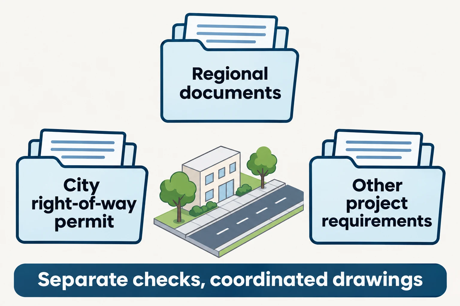
For water and wastewater work, the Regional and municipal documents answer different questions. Peel’s connection process addresses its water and wastewater application. Mississauga’s road occupancy process addresses the City’s right-of-way. A project may need both, with a consistent design passing between them.
This distinction is especially important when someone uses the word “approved” without naming the document. Ask for the actual approval or receipt, the issuer, the project reference and the associated drawings. A forwarding email or a verbal statement is not a substitute for identifying the records relied on for the next step.
A C-receipt is an input to the municipal route, not its replacement
Peel states that a Final Connection Receipt follows application approval and payment of final connection and engineering fees. Some municipalities require that receipt for their own process. Mississauga’s service-connection guidance expressly calls for the C-receipt with matching approved drawings for water and sanitary connections.
The practical lesson is to keep the receipt and its design record together. If a later proposal changes the connection shown in the drawings, do not assume that a previously issued receipt resolves the changed design. Identify the discrepancy and obtain direction through the responsible approval route before treating the package as coordinated.
Identify the parties named in the road occupancy application
The City’s checklist requires both the contracted-by and contractor information, including emergency contact details. It states that both parties become permit holders when the permit is issued. Therefore, an owner should not treat the named parties as a minor administrative detail that can be completed from an old project template.
Confirm who is contracting for the proposed work and who will perform it before the application is assembled. If a participant changes, ask the City how that affects the application or issued permit. Do not assume that naming a civil consultant on the design drawings makes that consultant the contractor or transfers construction obligations to them.
This distinction also improves the engineering handoff. The design team can identify the appropriate contact for a drawing question without taking responsibility for site execution. The applicant can separately ensure that the people identified for urgent contact are the correct current parties.
Road occupancy permit drawings: the public-road interface
The drawing package should let a reviewer locate the work and understand its relationship to existing public features. For that reason, the proposed service should not appear as an isolated line ending at the edge of a cropped private-site plan. Include enough context to make the interface intelligible.
Mississauga’s checklist calls for scalable drawings, location context, drawing conventions, relevant City infrastructure and offsets. It also identifies a cross-section requirement where utility plant crosses a road. These are submission requirements, not permission to invent unavailable elevations or underground conditions. Additional information may be requested for the particular project.
Use a common base while preserving information sources
Survey information, municipal records, utility information and design proposals do not have the same evidentiary status. A common drawing base helps coordination, but merging these layers should not erase their origins. Identify who supplied the information and what limitations need attention.
For example, an older record might help locate a possible connection without proving its present condition or precise position. The designer can then explain what needs confirmation. This is preferable to presenting an apparently complete drawing that leaves the owner unaware of a material assumption.
Make horizontal and vertical relationships understandable
The road interface is three-dimensional. A plan view can show where the proposed work sits along the frontage, while a section can explain relevant vertical relationships. These views should describe the same proposal and use consistent references.
Check that labels and drawing references agree across sheets. If a connection moves in plan, review whether the section and related dimensions also need revision. Do not retain an older section merely because it looks plausible. Ask the responsible professional to confirm the resulting design rather than treating drafting consistency as proof of engineering suitability.
| Record | Coordination question |
|---|---|
| Private-site plan | Where does the proposal reach the property boundary? |
| Connection drawing | Does the public-side arrangement match the accepted design? |
| Section or detail | Are the relevant vertical relationships and references consistent? |
| Approval document | Which exact drawing issue and scope does it support? |
Explain the extent of road occupancy separately from the service design
The location of a pipe is not the same as the extent of the space needed for the proposed work. The application team should distinguish the permanent service arrangement from the temporary occupation described for the project. Otherwise, the submission may explain the finished service while leaving the work’s public-space effects unclear.
This distinction does not require the civil designer to assume a contractor’s means and methods. Instead, it requires the appointed parties to exchange compatible information. The contractor’s proposed work arrangement and the designer’s service information should not contradict one another.
Identify who supplies construction and traffic information
Where work affects travel lanes, sidewalks or other public functions, the appropriate party must identify the resulting application needs. Do not treat a civil servicing plan as a substitute for a separately required traffic-management assignment. The permit applicant should confirm the applicable submission requirements with the City.
For project coordination, identify who will provide the proposed work dates, occupation extent and contact information. Keep these responsibilities distinct from the design calculations and drawings. A clearly allocated task is less likely to disappear between the owner’s consultant and contractor.
Account for the frontage as a shared public space
A frontage may contain more than the infrastructure shown on an early site sketch. Consider whether the current base identifies relevant sidewalks, boulevards, trees, transit features and other visible facilities. The purpose is to identify interfaces for review, not to authorize their removal or relocation.
If the proposed arrangement conflicts with a public feature, record the conflict. A design change, another permission or additional specialist input may be needed. The owner should understand that resolving the service connection alone may not resolve every other use of that space.
Build a coherent road occupancy application package
Use the City’s current service-connection application page to obtain the applicable form. Its publication entry is dated November 28, 2024. The age of a downloaded copy is a reason to check the current source, not a reason to assume the form is invalid or silently substitute another municipality’s template.
Keep the application description consistent with the drawings. If the proposal contains both a new connection and a disconnection, the package should not describe only one. Where several documents use different project names or references, clarify the relationship before submission.
Separate design readiness from administrative completeness
A technically coordinated drawing can still sit within an incomplete application. Conversely, a form with every box filled does not establish that the design is correct. Review these as separate questions so that an administrative check does not become an unsupported engineering signoff.
The project team can make a practical pre-submission list of required attachments and responsible parties. Include the actual application, relevant approval records, current drawings and other documents identified by the City. Refer insurance questions to the applicant and insurance provider rather than interpreting coverage through an engineering article.
Use specific descriptions instead of broad assurances
Statements such as “all services approved” hide useful distinctions. A better internal description identifies the service, the document and the remaining dependency. For example, “water connection drawings accepted for the stated arrangement; municipal road occupancy application still being assembled” tells the next person what to do.
This is a communication practice, not prescribed wording for a municipal form. Adapt it to the actual project record. Above all, do not turn a conditional response into an unconditional claim when summarizing it for the owner or contractor.
Read the application form as a description of impacts
The City’s Form 2924, revised November 2024, separates applicant information, location, work description, traffic management, physical impacts and supporting documents. This structure is useful because a service connection can affect several things at once. Describing only the pipe does not answer every part of the application.
The form asks about connections, trenches, disconnection pits and various public-space effects. Those fields should reflect the actual proposal supplied by the responsible parties. Do not infer a construction arrangement from a preliminary line on a plan merely to complete the form.
Check location information at the level the work actually occupies
A municipal address helps identify the property, but a reader may still need to understand which frontage or street segment is involved. Corner properties, multiple frontages and work extending beyond one entrance can make an abbreviated description ambiguous. A clear location reference helps the design and application teams discuss the same place.
Compare the written location with the drawing key plan and the affected frontage. If one document describes the north frontage while another shows work on the side street, resolve that difference before circulating the package. This is a consistency check; it does not establish ownership, survey boundaries or permission to use a neighbouring property.
Describe impacts without deciding specialist requirements yourself
Form 2924 identifies matters such as lane, sidewalk, cycling and transit impacts. Identifying an affected facility is different from designing an acceptable response. The appropriate party must determine the measures and approvals required for the actual work.
For instance, an owner’s early sketch may show a clear route beside the work, but that sketch does not establish an approved pedestrian arrangement. The owner should ask who is responsible for developing the applicable information and communicating with the City. The civil design team can identify interfaces without claiming to replace that assignment.
Keep temporary effects distinct from permanent restoration
The proposed service, temporary work area and final public-space condition are different descriptions. Keep them distinguishable in discussions about scope and cost. A private-site drawing may describe the finished property while the road occupancy documents address other responsibilities outside it.
The current form addresses restoration deposits and the City’s permanent restoration role. Confirm those provisions directly for the project rather than assuming that a contractor’s private quotation includes every municipal cost. An engineering fee, a contractor’s price and a municipal deposit should not be presented as one interchangeable amount.
Ask for a written scope breakdown where the commercial arrangements are unclear. Identify which party is supplying design information, which is carrying out the contracted work and which charges come from an authority. This does not require the designer to provide insurance, legal or financial advice; it requires the project record to distinguish the obligations being discussed.
Finally, keep design decisions separate from price assumptions. A cheaper proposed arrangement is not automatically suitable, and an accepted quotation is not evidence of permit issuance. The owner should be able to trace the proposed work back to the current drawings and identify which approvals are still required before committing to a construction sequence.
Locate the work → identify its public-space effects → obtain the responsible parties’ information → reconcile drawings and records → submit through the applicable City route.
This is an owner-facing coordination sequence, not a prescribed construction method or a substitute for the current application requirements.
Road occupancy permit revisions: preserve the approval trail
A project can change after a drawing package has been circulated. A connection location, building arrangement or construction proposal may no longer match the earlier information. Identify the change before using an older approval as evidence for the revised work.
Start with a concise description of what changed and which documents are affected. The appropriate authority and responsible professionals can then determine the required response. Do not assume that a change is minor simply because it occupies a small area on the plan.
Check both sides of a revised property-boundary connection
A shifted private-side service may affect the public-side connection information. Similarly, a constraint discovered in the right-of-way may require reconsideration of the arrangement inside the property. The project should not maintain two inconsistent solutions merely because different parties prepared the drawings.
Ask the design team to identify the controlling revision and communicate it to the affected participants. Retain superseded files as records, but make their status clear. This helps prevent a technically sound current drawing from being undermined by an older attachment in someone else’s package.
Distinguish a field change from a permit extension
Mississauga directs applicants to contact its permit administration team for field changes or extensions. A proposed change to the work and a change to the permitted dates are different issues, even when they arise together. The project team should explain both rather than assuming that resolving one resolves the other.
For example, a scheduling delay might leave the physical design unchanged. A changed connection arrangement might affect the design even if the requested dates stay the same. Keep the issue description precise and obtain the applicable direction before treating the existing package as sufficient.
A useful revision note identifies: the changed condition, the affected drawings, the approval records that may be affected, the party responsible for review and the decision still needed. It should not state that revised work is authorized before that has been established.
Plan the handoff before the proposed work date
A proposed start date is a planning input, not evidence that permission has been issued. Build the project sequence around the actual dependencies. The owner should know which items are awaiting design information, which are under review and which have been issued for the stated scope.
Avoid promising a single approval duration for every application. Site conditions, completeness, changed work and other approvals can affect the sequence. The City’s current guidance advises submitting in advance and does not guarantee issuance simply because an application has been sent.
Prepare a usable issue package for the appointed parties
The final handoff should make it easy to identify the current drawings and relevant permissions. Use a clear file list, consistent revision references and a contact route for questions. This is particularly helpful when the owner, designer and contractor have participated at different times.
Do not add technical instructions outside the professional assignment to make the package look comprehensive. Where another party’s document is required, identify it and its author. A transparent boundary is more reliable than a vague statement that the consultant has covered every construction consideration.
Bring transit and frontage constraints into the application discussion
Form2924 asks applicants to identify certain transit-project and infrastructure impacts. Those questions deserve a project-specific response, not a default “no” copied from a previous application. The proposed work may occupy a frontage used by more than one public function.
Where the project team identifies a possible transit interface, establish which party will obtain the necessary direction. A civil drawing can show the connection location, but it does not independently authorize moving a stop, blocking access or altering transit facilities. Keep those decisions with the responsible authority and appointed specialists.
Ask the parties to compare the actual occupation proposal against the current site information. If a route or facility is affected, describe the issue clearly in the application discussion. Avoid promising that a short work duration makes the impact exempt or that a different contractor automatically eliminates the need for coordination.
Illustrative service-connection coordination situations
The following situations are hypothetical planning examples, not completed Elmid Design Inc. projects or promises of municipal acceptance. They show how the separate documents can affect an owner’s decisions. Actual requirements depend on the property, proposed work and reviewing authorities.
A dwelling project has a receipt but no municipal road permission
Imagine an owner receives the Regional connection documentation and assumes the contractor can begin the public-side work. The missing question is whether the City’s applicable road occupancy permission has also been issued. The two documents are related, but they have different purposes.
The useful next step is to reconcile the actual receipt, its approved drawings and the municipal application status. If a document is missing, identify who must obtain it. Do not describe the project as fully authorized simply because the Regional component is complete.
A revised frontage changes the proposed connection arrangement
Consider a redevelopment whose entrance and frontage design change after the service drawings were prepared. The service may now conflict with another part of the proposal. Reusing the old public-side drawing without review would conceal that interface rather than resolve it.
The design team should compare the current site layout with the connection package and identify affected approvals. The owner can then understand whether further coordination is needed before the municipal submission proceeds. The example does not establish that every entrance change requires the same response.
A proposed lateral turns out to involve wider infrastructure work
In another hypothetical case, the initial description suggests a simple connection, but the developed proposal includes work beyond that route’s scope. Choosing the form first has obscured the actual approval question. The project needs a confirmed infrastructure description before the correct application path can be established.
The responsible team should explain the distinction to the authority and obtain direction. It should not relabel the same broader work as a lateral connection to fit an easier form. The goal is a coordinated, accurate submission, not a particular permit category at any cost.
Related Mississauga civil-design experience
Elmid Design Inc.’s public project portfolio includes grading and servicing drawings for a proposed two-storey dwelling in Mississauga. The work coordinated lot levels, swales and subdrains, water and sanitary connections, and sediment-control hoarding, with revisions addressing municipal and Regional comments. This illustrates civil design coordination; it does not establish that Elmid obtained a road occupancy permit or performed the construction.
How Elmid Design Inc. can support the civil design package
Elmid Design Inc. provides site-servicing engineering and design coordination within the agreed project scope. Relevant deliverables can include coordinated servicing drawings and related grading information for the proposed property and connection interface. The actual assignment should identify the required inputs, design responsibilities and exclusions before work begins.
For a Mississauga road occupancy permit involving service connections, the civil-design contribution should be described precisely. It may involve aligning the proposed service layout with the site plan and reviewing drawing consistency across the property boundary. It does not mean Elmid issues the permit, installs utilities, guarantees acceptance or replaces separately appointed construction and traffic professionals.
Bring the available survey, current building or site proposal, existing service information and any authority comments to the scope discussion. Also identify which Regional and municipal steps have already occurred. This helps the engineering team respond to the actual decision still needed rather than repeat work that another document already addresses.
Frequently Asked Questions
Does a Mississauga road occupancy permit replace a building permit?
No. The road occupancy permit addresses the stated use of the City’s right-of-way. Building and other approvals have their own purposes. Identify the documents required for the specific proposal rather than treating one permit as a substitute for all others.
Is a Peel C-receipt the same as road occupancy permission?
No. The receipt is a Regional connection-process document. Mississauga requires it with matching approved drawings for the relevant water or sanitary road-occupancy application, but that does not make it the City’s permit.
Can the service-connection route cover a mainline extension?
Not under the City’s stated service-connection route. Mississauga directs mainline and other infrastructure work to different processes. Confirm the actual work description with the appropriate authority before selecting an application.
Who prepares the drawings for a service connection permit?
The appropriate appointed professional prepares the design information within their assignment. The owner should confirm the required qualifications and document responsibilities for the project. Contractor, insurance, utility and traffic-related submissions should not be silently included in a civil consultant’s scope.
What if the connection changes after drawings have been approved?
Identify the changed condition and affected documents, then seek direction through the responsible design and approval routes. Do not assume an earlier approval applies to a different arrangement. The required response depends on the nature of the change.
How long will the road occupancy application take?
There is no reliable universal duration for every service-connection application. The City advises applying in advance, and incomplete information can affect review. Confirm current project-specific expectations rather than planning construction around an assumed approval date.
Does this guide authorize work in the road or boulevard?
No. This is design-coordination information, not a permit or construction instruction. The applicable authority must issue the necessary permission for the stated work, and the appointed parties remain responsible for their respective professional and construction obligations.
Geographic Locations That We Service:
Elmid Design Inc. provides professional engineering and design consulting for site servicing across the Ontario service areas below. The agreed scope depends on the proposed work, site evidence and applicable review requirements.
We provide engineering services across a wide range of municipalities, each with its own requirements and review processes.
Toronto and Surrounding Areas
We provide engineering services in Toronto and provide grading engineering resources through our Toronto grading plan page.
Our service area also includes Oshawa, Pickering with our Pickering grading plan resources, and Clarington.
Our engineering services also cover Ajax through our Ajax grading plan resources, Whitby, Brock, Scugog, and Uxbridge, including our Uxbridge grading plan resources.
Halton Region
Within Halton Region, we provide engineering services in Burlington, including projects requiring Burlington grading plans.
Our engineering services also cover Halton Hills, supported by our Halton Hills grading plan resources.
Our service area also includes Milton and Oakville, including our Oakville grading plan resources.
Peel Region
Within Peel Region, we provide engineering services in Brampton, including projects requiring Brampton grading plans.
Our engineering services also cover Mississauga through our Mississauga grading plan resources and Caledon through our Caledon grading plan resources.
York Region
Within York Region, we provide engineering services in Vaughan and provide information about Vaughan grading plans.
Our engineering services also cover Aurora through our Aurora grading plan resources and East Gwillimbury through our East Gwillimbury grading plan resources.
Additional service areas include Georgina with our Georgina grading plan resources, Markham with our Markham grading plan resources, and Newmarket with our Newmarket grading plan resources.
Our engineering services also cover Richmond Hill with our Richmond Hill grading plan resources, Whitchurch-Stouffville through our Whitchurch-Stouffville grading plan resources, and King through our King grading plan resources.
Our service area also includes Bradford West Gwillimbury.
Other Southern Ontario Cities and Towns
We provide engineering services in many additional Southern Ontario communities, including Hamilton, St. Catharines, Niagara-on-the-Lake, Brant, Cambridge, Kitchener, Waterloo, and Woodstock.
Our engineering services also cover Guelph, Centre Wellington, Shelburne, Orangeville, New Tecumseth, Essa, Collingwood, Wasaga Beach, and Barrie, including our Barrie grading plan resources.
Additional service areas include Midland, Orillia with our Orillia grading plan resources, Ramara, Minden Hills, North Kawartha, Kawartha Lakes, Peterborough, Selwyn, and Brighton.