Stormwater Infiltration Testing and Design Rates in Ontario
Stormwater infiltration testing in Ontario supplies evidence for an infiltration rate comparison. Soil testing for infiltration systems must remain tied to the proposed feature and qualified interpretation.
From stormwater infiltration testing to a design input
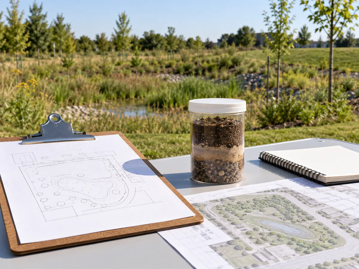
A stormwater infiltration test result becomes useful when the designer can trace it to a place, depth, method and proposed feature. The selected design infiltration rate needs a documented interpretation of that evidence. It is not simply the fastest number in a report.
Keep three questions separate: what the investigation measured, what the specialist concluded, and what the stormwater design assumes. A clear link between those questions helps an owner recognize missing information before a drawing or calculation relies on it.
What stormwater infiltration testing can establish
Stormwater infiltration testing examines how water enters or moves through ground under the conditions of a particular investigation. It can help the project team evaluate a proposed infiltration feature. However, a result describes the tested conditions, not every location or future condition on the property.
For an owner, the useful starting point is the decision the investigation must support. A preliminary screening exercise and verification for a selected design may need different information. Explain the proposed development and the intended stormwater feature before commissioning the investigation.
The Sustainable Technologies Evaluation Program, or STEP, presents infiltration investigation as a sequence of background review, subsurface observations, testing and design interpretation. Its infiltration-testing guidance also distinguishes screening from verification. That is a useful reason to agree on purpose before arranging fieldwork.
Measured results and design rates answer different questions
A measured result records behaviour under a stated procedure. A design infiltration rate is an input selected for a proposed engineering assessment. The designer needs to explain how the investigation supports that input and what limitations apply.
Consequently, an owner should not ask a laboratory certificate or a short test summary to do the work of a design report. Nor should a drawing use an unexplained number merely because it appears in a consultant’s email. Keep the interpretation attached to the evidence.
The distinction also helps when comparing proposals. One consultant may price a limited investigation, while another includes interpretation and a report. Ask which deliverable will allow the stormwater designer to make the required decision.
Identify the ground and the proposed feature
A proposed rain garden, infiltration trench or other measure has a location and an intended relationship with the surrounding ground. The investigation should relate to that arrangement. A result from a convenient open corner may not represent the footprint eventually selected.
Likewise, surface appearance cannot establish the behaviour of a deeper soil layer. A lawn can conceal fill, disturbed ground or a change in native material. The project team needs records that connect the investigated conditions to the design location.
Use a current layout when discussing the investigation scope. Mark options as preliminary, and tell the specialist when the location or depth changes. This avoids treating an early sketch as a final instruction.
Keep native soil, filter media and septic evidence separate
Not every report mentioning permeability or water movement supplies the same design input. First identify the material under discussion. Native ground beneath a proposed feature, imported filter media and a septic disposal area have different roles in a project.
STEP’s design infiltration rate guidance concerns native soils around an infiltration practice. It expressly distinguishes that subject from the hydraulic properties of planting or filter media. The terminology should remain equally clear in the project records.
Native-soil evidence is not a filter-media certificate
A supplier’s media certificate may describe the material intended for a planted treatment feature. It does not establish the properties of the receiving native ground. Conversely, a site investigation does not certify the properties of a future delivered media blend.
Ask the design team to identify both inputs where the proposal relies on both materials. The drawing should distinguish their locations. A calculation and specification should also make clear which property belongs to which layer.
This matters when a material changes during procurement. Replacing one media blend may need review even though the native-soil evidence has not changed. The relevant question is whether the proposed substitution preserves the intended function.
A septic T-time is not an automatic stormwater design rate
A septic soil assessment supports an on-site sewage-system design. Its test locations, interpretation and applicable requirements relate to that purpose. An infiltration proposal for stormwater may concern another footprint, depth or performance question.
Therefore, do not turn a septic result into a stormwater design rate simply by converting units. Mathematical conversion cannot establish that the investigation method or interpretation suits the new purpose. Ask the responsible professionals whether the original evidence can contribute and what remains missing.
The same caution applies in reverse. A stormwater investigation does not automatically supply all evidence needed for a sewage-system design. Keep the two assignments distinguishable in the owner’s records.
Plan stormwater infiltration testing around the actual question
Before the investigation starts, write down what the project team needs to decide. For example, the question might concern a proposed location, uncertainty in a deeper layer, or whether an earlier report represents a revised layout. These are more useful instructions than a general request to test the property.
The owner can help by collecting available surveys, previous reports and development sketches. However, the qualified investigation professional should determine the appropriate field methods and reporting scope. This article is a commissioning and records guide, not a procedure for carrying out a test.
Give the investigator a current, identifiable layout
Send the drawing title, date and revision with the investigation request. Identify the potential stormwater footprint and relevant levels if the design team has established them. Mark unresolved options clearly rather than presenting them as fixed.
Also explain known constraints, including access restrictions and areas disturbed by earlier work. A specialist can then assess how those conditions affect the investigation. Do not assume that an old report or neighbouring borehole removes the need for project-specific advice.
If several concepts remain under consideration, say so. The investigation may need to support a comparison rather than a single predetermined location. Keeping that purpose visible helps prevent decisions from outrunning the available evidence.
Agree on responsibilities before fieldwork
Identify who commissions the investigation, who supplies site information and who interprets the findings. Also establish how the stormwater designer will receive the complete report and ask follow-up questions. A missing communication step can make otherwise useful data difficult to apply.
Access, utility locating, excavation safety and reinstatement belong with the parties responsible for the fieldwork. Owners should not improvise test pits or enter excavations to collect a missing observation. Discuss practical constraints with qualified professionals before work starts.
Elmid Design Inc. provides stormwater engineering and drainage design within an agreed scope. Soil investigation and testing require the appropriate external specialist. Do not assume that requesting a stormwater report automatically commissions field testing.
A practical evidence chain
Investigation record → specialist interpretation → selected design input → calculation → drawing. Each handoff should identify its source and purpose. If the proposed feature moves, the team should review the affected links rather than changing only its outline.
Read the stormwater infiltration test record before its conclusion
A clear report should let the reader identify what was investigated and where. This does not mean the owner must reproduce the specialist’s calculations. It means the supporting record should be understandable enough to request a clarification when something does not match.
Begin with the investigation date, report revision and location plan. Then review the test identifiers, depths, methods and observations. Finally, read the interpretation and recommendations together with their stated limitations.
Location identifiers connect the result to the footprint
A test identifier is useful only if the team can find it on a plan. Check that the report’s labels match its figures and schedules. Similar identifiers on different documents can otherwise create an unnoticed mix-up.
For a revised layout, ask the specialist whether the investigation remains representative. A nearby location is not automatically equivalent. The appropriate response depends on the site evidence and the change being considered.
Keep the original location plan with the report. A screenshot containing only a result removes the information needed to interpret its relationship to the proposed work.
Depth needs a clear reference
A depth measured below existing ground and an elevation on a survey are different forms of information. The team must understand the reference used in the investigation. That relationship becomes especially important where proposed grading changes the surface.
Ask whether the record identifies the investigated layer and its relationship to the proposed feature. If the design requires a connection between a reported depth and a drawing elevation, the responsible professionals should establish that link.
Do not infer a layer’s extent from one isolated figure. Where the information does not resolve the design question, record the gap and obtain an appropriate interpretation.
Method, units and observations belong together
Different investigation methods can produce results with different meanings and limitations. Retain the method description rather than reducing the report to a value and unit. A spreadsheet should not conceal those distinctions by placing every result in one unlabeled column.
Units also need attention. Confirm that the calculation uses the intended quantity and conversion. A numerical conversion can be correct while the assumption behind its use remains inappropriate.
Keep relevant observations with the result. Notes about the investigated material, water encountered or limitations of access can affect how a specialist interprets the evidence. They are not optional decoration around the final number.
Read the result together with its context
- Location and depth identify the investigated ground.
- Method and units explain what the reported value represents.
- Observations and limitations qualify how the evidence can inform design.
Groundwater and soil variability can change the interpretation
A proposed stormwater feature depends on more than one soil measurement. The specialist and design team need to consider relevant subsurface conditions and the limits of the investigation. A dry-looking excavation at one visit does not establish every seasonal condition.
Ask which groundwater observations support the interpretation and whether further information is needed. Keep an observed condition separate from an estimated or assumed one. The report should make that distinction clear enough for the design team to follow.
Conflicting results need explanation, not a convenient average
Different results may reflect different layers, locations, methods or investigation conditions. The difference is a reason to ask for interpretation. It does not automatically identify an error, and it does not justify choosing the value that makes the preferred layout fit.
The specialist should explain which evidence applies to the proposed arrangement. The answer may require more information, a revised concept or a documented limitation. An owner should retain that explanation alongside the report.
Do not apply a universal averaging rule or safety factor from an online article. The selected approach needs a technical basis appropriate to the evidence, proposed system and applicable review criteria.
| Record | What to confirm | What not to assume |
|---|---|---|
| Site test result | Method, location, depth and interpretation | Every part of the property behaves the same way |
| Media certificate | Specified material and relevant property | It describes the receiving native ground |
| Earlier report | Scope and relationship to the current proposal | Its conclusion transfers without review |
| Selected design rate | Supporting evidence and stated limitations | It independently proves the whole drainage design |
Document how stormwater infiltration testing informs the design rate
The design record should identify the source of the selected rate and explain its intended use. It should also state relevant limitations. This allows a reviewer to follow the decision without guessing which test or later clarification the designer relied on.
STEP discusses interpretation and conservative adjustment of measured evidence in its design-rate guidance. That does not establish one factor for every Ontario proposal. The project team needs to identify the approach applicable to the actual system and reviewing authority.
Keep source values and adopted values distinguishable
A clear calculation schedule can show the source reference separately from the adopted design input. It should not overwrite the original evidence with an adjusted value and leave the adjustment unexplained. Retain the report and any specialist clarification as supporting records.
Likewise, identify whether the input is preliminary or accepted for the current design stage. A working assumption can help assess options, but it should not silently become a verified final condition.
When new evidence arrives, review the affected design work. Changing a number in a model may also affect the proposed footprint, storage arrangement or drawings. The calculation and physical design must remain connected.
Do not confuse a design rate with complete feasibility
A supported infiltration rate does not answer every question about the stormwater proposal. The site still needs an appropriate arrangement for the contributing runoff, nearby features, overflow and maintenance. Other constraints may influence whether the concept remains suitable.
For example, a feature could have useful ground information but an unresolved overflow route. Alternatively, its location could conflict with a revised building or utility corridor. The investigation result does not settle those separate issues.
Keep the design discussion broad enough to address those interfaces, while keeping this record focused on the evidence behind the input. A good input supports the engineering assessment; it does not replace it.
Carry the infiltration evidence into drawings and review responses
The final design documents should describe the same proposed feature as the calculation. Check its label, location and relevant levels against the supporting record. A report can be internally clear yet become disconnected from a later drawing revision.
A useful review response identifies both the question and the document that answers it. If a reviewer asks about the selected rate, direct them to the source, interpretation and design assumption. Merely repeating the number does not explain its basis.
Use a report-to-drawing cross-reference
A short cross-reference can connect the investigation reference, design input and affected drawing. This is especially helpful where a site contains several proposed features or investigation areas. Use names that remain consistent across the package.
The owner does not need a second technical report to maintain this index. A concise document list can identify the responsible consultant, revision and current purpose. Keep superseded material available as history, but distinguish it from the current design basis.
Where a clarification changes a conclusion, attach the clarification to the original report. Do not let a standalone email become the only place where the final interpretation exists.
Resolve an infiltration evidence change across the whole package
A report and calculation may show different values for an apparently identical test. First compare their complete references. A table heading, footnote or later clarification may explain the difference. Identify the report page, test label and reported quantity alongside the calculation cell or schedule entry in question.
Preserve the original report as received. Do not change it to make the documents agree or replace a design input because another value looks more plausible. Instead, send a precise query to the responsible professional. Where units differ, ask whether the discrepancy reflects transcription, conversion or deliberate interpretation.
Track corrected stormwater infiltration testing evidence
- Clarify the source. Obtain a written explanation of the intended value, units and meaning. Ask the author whether the source document needs revision and which issue should govern the disputed entry.
- Trace the consequences. Identify the calculations, report summaries, drawing notes and response letters that use the information. A label correction and a changed design input can have different consequences. The designer determines which dependent work needs review.
- Confirm the revised status. Record the answer, responsible author and affected document issues. A changed number does not turn a preliminary assumption into verified evidence. The author must support any change in that description.
- Close the query consistently. Mark it resolved when the relevant team confirms how it has incorporated the answer. Distinguish the internally corrected package from the version actually submitted to the authority.
- Hand over the decision history. If another consultant joins, send the current evidence package with the accepted clarification and any remaining questions. Identify the design stage it supports instead of leaving the recipient to choose among unnamed attachments.
The receiving consultant still assesses the material within its own assignment. An organized handover does not transfer professional responsibility or establish that earlier conclusions remain suitable. Keep subsequent questions connected to the same record so the project retains a clear evidence history.
Track layout changes that can reopen the question
A moved footprint, changed excavation level or revised grading arrangement can affect the relationship between testing and design. Notify the responsible professionals before assuming the previous evidence still applies. The appropriate next step may be confirmation rather than a complete new investigation, but it requires review.
Similarly, a changed catchment or operating concept can affect the design assessment even when the tested ground remains the same. Keep the reason for the change visible so the team can identify the relevant dependencies.
Avoid promising that a report remains valid indefinitely or becomes invalid after one universal period. Its usefulness depends on its content, the current proposal and the conditions being assessed.
Before relying on an earlier investigation
- Compare the current footprint and levels with the investigated layout.
- Flag changed catchments, grading or operating assumptions.
- Ask the responsible professionals which conclusions still apply.
Illustrative stormwater infiltration testing decisions
The following hypothetical situations show how an owner can keep the evidence connected to design decisions. They are not completed projects, approved layouts or instructions for selecting a numerical infiltration rate.
A proposed infiltration footprint moves after testing
A concept initially reserves a landscaped strip beside a parking area. Later, the architectural team moves the building and relocates the strip. The owner now has a test report referring to the earlier arrangement.
The useful response is to send the revised plan to the specialist and stormwater designer together. Ask whether the evidence represents the new location and what remains uncertain. Do not relabel the old test point on the new plan to make the documents appear consistent.
The decision record should identify the original location, the revised footprint and the professional’s conclusion. If further work is needed, the team can address it before detailed design relies on an unsupported assumption.
A supplied material has a different reported property
A landscape package proposes a different filter-media blend from the one considered earlier. Its certificate reports a hydraulic property, but the stormwater report also contains a native-ground infiltration assumption. Those records concern different materials.
The owner should request a coordinated review rather than replacing one number with the other. The relevant designers can assess the media change while retaining the separate ground interpretation. This keeps the proposed material and the receiving-ground evidence from becoming mixed.
The resulting record should explain which specification or calculation changed. It should also state whether the change affects drawings, planting requirements or other project information.
An earlier report provides a result without enough context
An owner receives a short table from a previous consultant. It lists a rate but does not include the investigation plan or method description. The project team cannot yet connect the value to the proposed feature.
First request the complete report and supporting clarification. The missing information may already exist. If it does not, ask the qualified specialist what investigation or interpretation is needed before relying on the result.
This approach avoids two premature conclusions: that the number is automatically usable, or that every previous record must be discarded. The decision follows the evidence rather than the age or appearance of the table.
Stormwater design support from Elmid Design Inc.
Elmid Design Inc. provides stormwater engineering, drainage design and coordinated supporting drawings within the agreed assignment. We can review supplied investigation reports for their relationship to the proposed stormwater design and identify questions requiring clarification from the responsible specialist.
The engineering scope may connect the drainage strategy, calculations, grading and servicing information. It does not turn Elmid Design Inc. into a soil-testing or geotechnical investigation provider. Arrange those services with appropriately qualified external professionals.
When requesting a proposal, provide the property location, current layout, available survey, complete investigation reports and written review comments. Explain whether the immediate task is option assessment, detailed design or a response to a particular technical question.
The stormwater management report service explains the broader design scope. A clear appointment should identify deliverables, required external inputs and responsibilities without promising municipal acceptance or a fixed approval date.
Frequently Asked Questions
Is a measured infiltration result the same as the design rate?
Not automatically. A measured result describes a particular investigation. The design rate needs an interpretation that relates the evidence to the proposed feature and applicable criteria. Keep the source and adopted input distinguishable.
Can a filter-media certificate replace stormwater infiltration testing?
No. A filter-media certificate describes a supplied material, not the receiving native ground. The designer should identify which properties the proposed arrangement needs and obtain the appropriate evidence for each.
Can I convert a septic T-time into a stormwater design rate?
A unit conversion alone does not establish suitability. The methods, location, depth and design purpose may differ. Ask the responsible specialists whether the original evidence can contribute to the stormwater assessment.
Does a favourable result guarantee an infiltration proposal will work?
No. The complete design must address relevant site constraints, the proposed runoff, the physical arrangement and applicable review requirements. One supported input does not establish every aspect of feasibility or approval.
Does Elmid Design Inc. carry out infiltration field testing?
This service is engineering and design consulting, not field soil testing. An appropriate external specialist should undertake and interpret the investigation. Elmid Design Inc. coordinates the supplied evidence with the agreed stormwater design work.
What should I send if my stormwater feature has moved?
Send the revised layout and the complete earlier investigation report to the responsible professionals. Ask whether the evidence still represents the proposed location and depth. Record their conclusion before relying on the previous design input.
Geographic Locations That We Service:
Elmid Design Inc. provides stormwater management engineering and design consulting across Ontario service areas. The agreed scope depends on the proposed work, available evidence and applicable review requirements.
We provide engineering services across a wide range of municipalities, each with its own requirements and review processes.
Toronto and Surrounding Areas
We provide engineering services in Toronto and provide grading engineering resources through our Toronto grading plan page.
Our service area also includes Oshawa, Pickering with our Pickering grading plan resources, and Clarington.
Our engineering services also cover Ajax through our Ajax grading plan resources, Whitby, Brock, Scugog, and Uxbridge, including our Uxbridge grading plan resources.
Halton Region
Within Halton Region, we provide engineering services in Burlington, including projects requiring Burlington grading plans.
Our engineering services also cover Halton Hills, supported by our Halton Hills grading plan resources.
Our service area also includes Milton and Oakville, including our Oakville grading plan resources.
Peel Region
Within Peel Region, we provide engineering services in Brampton, including projects requiring Brampton grading plans.
Our engineering services also cover Mississauga through our Mississauga grading plan resources and Caledon through our Caledon grading plan resources.
York Region
Within York Region, we provide engineering services in Vaughan and provide information about Vaughan grading plans.
Our engineering services also cover Aurora through our Aurora grading plan resources and East Gwillimbury through our East Gwillimbury grading plan resources.
Additional service areas include Georgina with our Georgina grading plan resources, Markham with our Markham grading plan resources, and Newmarket with our Newmarket grading plan resources.
Our engineering services also cover Richmond Hill with our Richmond Hill grading plan resources, Whitchurch-Stouffville through our Whitchurch-Stouffville grading plan resources, and King through our King grading plan resources.
Our service area also includes Bradford West Gwillimbury.
Other Southern Ontario Cities and Towns
We provide engineering services in many additional Southern Ontario communities, including Hamilton, St. Catharines, Niagara-on-the-Lake, Brant, Cambridge, Kitchener, Waterloo, and Woodstock.
Our engineering services also cover Guelph, Centre Wellington, Shelburne, Orangeville, New Tecumseth, Essa, Collingwood, Wasaga Beach, and Barrie, including our Barrie grading plan resources.
Additional service areas include Midland, Orillia with our Orillia grading plan resources, Ramara, Minden Hills, North Kawartha, Kawartha Lakes, Peterborough, Selwyn, and Brighton.