
Drainage easement grading plan · Ontario
Grading Plans and Drainage Easements in Ontario
Surveys and design constraints: coordinate property records, drainage routes and proposed ground levels with Elmid Design Inc.
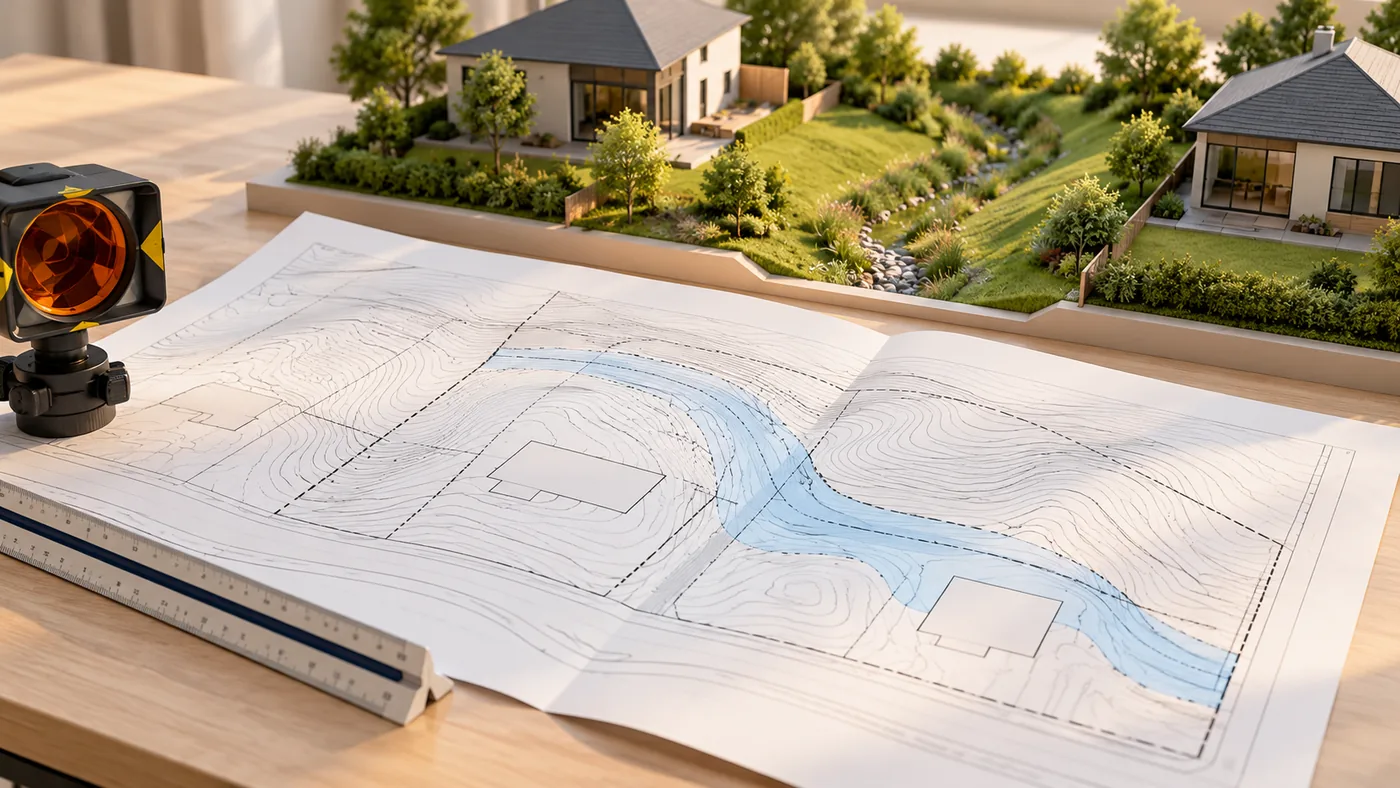
Illustrative grading and drainage concept. Not a survey, registered easement plan or construction drawing.
A drainage easement grading plan must coordinate the proposed ground levels with the easement’s surveyed location, confirmed terms and drainage function. In Ontario, the engineer needs reliable survey information and property records before deciding how a swale, pipe, access route or building layout can fit. A line on a drawing alone does not establish the right to discharge water, alter an easement or enter neighbouring land.
Key Takeaways
- A grading plan describes drainage design. A survey provides spatial evidence, while registered documents require appropriate legal interpretation.
- Existing easements, observed drainage routes and approved drainage arrangements may not occupy the same area. Resolve differences before detailed design.
- Check both surface water movement and underground infrastructure. A clear strip above a pipe may also serve maintenance access.
- Municipal submission requirements vary. Toronto, Oakville, Mississauga and Richmond Hill provide useful examples, rather than one Ontario-wide checklist.
- Confirm how proposed and temporary work affect the corridor. Keep the final design, permissions and construction records coordinated.
What a Drainage Easement Grading Plan Must Address
A drainage easement can affect where a project fits and how the finished property drains. It may involve a surface route, underground infrastructure or related access. Its precise purpose and restrictions depend on the relevant documents and circumstances.
For an owner, the practical question is broader than whether a proposed structure overlaps a dashed line. Can the design preserve the required drainage function? Can the infrastructure remain accessible? Does the proposed use fit the confirmed property rights and applicable approvals?
This article uses “drainage easement grading plan” as a descriptive term for a grading design affected by an easement. It does not identify a separate province-wide permit category.
Elmid Design Inc. provides site grading and drainage engineering for Ontario projects. The engineering role is to develop and coordinate the design using suitable evidence. Boundary determination and legal interpretation require the relevant professionals.
Start with the physical route and the documented corridor
A shallow depression can carry runoff without resembling a built drainage facility. Conversely, a visible catchbasin may connect to a buried pipe whose route is unclear from the surface.
Start by comparing three things: the land as measured, the available approved drainage drawings and the easement information. Each can reveal a different part of the problem.
Do not assume that a fence follows the legal boundary or marks the easement limit. Likewise, the absence of an obvious ditch does not establish that the land has no drainage constraint.
The goal is a coordinated explanation of where water moves, what the records describe and which questions remain unresolved. That explanation gives the design team a sound starting point.
Four Records Behind Drainage Easement Grading Plans
Different records answer different questions. Collecting them together helps prevent a design decision from relying on a document that was prepared for another purpose.
Survey evidence for grading plans with drainage easements
Boundary surveying addresses the location of property limits. A topographic survey records ground levels and physical features within its scope. A Surveyor’s Real Property Report can show improvements in relation to boundaries and include the surveyor’s written findings.
The Association of Ontario Land Surveyors’ SRPR guidance explains this relationship between the plan, improvements and report. Ask the surveyor which product and additional measurements suit the proposed work.
An existing survey may be useful without containing enough elevation information for drainage design. Its date, purpose, coverage and limitations all matter. A clear copy of an old plan is not evidence that current ground conditions are unchanged.
Property records: what documents need legal review?
Ontario’s land registry contains official records of ownership and other legal interests. The province directs users to OnLand for current and historical records and notes that professional help may be necessary to interpret them. See Ontario’s land registry overview.
Ask the lawyer handling the property review for the relevant registered instruments, referenced plans and any explanation needed for the project. A parcel register entry can point toward another document; it should not become a substitute for reading that document.
For engineering coordination, request clear answers about the affected land, purpose, parties and proposed work. The engineer can then identify design consequences without offering a legal opinion on the owner’s rights.
Approved drawings: what drainage arrangement was intended?
An approved grading or servicing drawing can explain why a swale or catchbasin exists. It may show drainage from several properties, a defined outlet or an overflow route that is difficult to recognize on site.
However, an approved drawing describes an intended arrangement at a particular stage. Construction changes, later alterations and settlement may produce different conditions.
Compare the approved design with current measurements. Where available, review record drawings, inspection correspondence and final grading documents as additional evidence.
Therefore, keep proposed, approved and as-constructed information clearly labelled. A design revision should not silently replace the historical record that explains the existing drainage system.
Survey Scope for a Drainage Easement Grading Plan
The survey scope for a drainage easement grading plan depends on the design question. Measuring only the proposed building corner may miss the low point that controls the entire side yard.
Before fieldwork, the engineer and surveyor should identify the features needed to understand the drainage corridor. That discussion can reduce repeat visits and avoid drawing a solution beyond the measured area.
Measure the corridor, its crossings and its outlet
Useful survey information may include the swale bottom, adjacent high points, catchbasin rims and the ground around them. Walls, fences, steps and driveway edges can change how water enters or leaves the route.
Where relevant and obtainable, pipe information can help establish the connection between surface collection and the underground system. An invert is the elevation of the inside bottom of a pipe. It answers a different question from the ground elevation above it.
The survey scope should also consider the corridor’s outlet and nearby vulnerable openings. Without this context, a low point can appear harmless even though water has no suitable route beyond it.
Arrange any necessary access before collecting information on other land. Do not assume that commissioning a grading design authorizes entry onto a neighbour’s property.
Survey coordination note
Use a consistent elevation reference
A benchmark is a known reference used to establish elevations. Drawings that use different references can contain numbers that look compatible but describe different heights.
Record the survey source, date and elevation reference on the design. When combining files, confirm that the measurements use compatible units and datums, or document the appropriate reconciliation.
Also ask about areas that could not be measured. Dense vegetation, locked gates or inaccessible features can leave important gaps.
A drainage easement grading plan should make these gaps visible. It is better to reserve a decision than to label an assumed level as measured.
Assign boundary and engineering questions correctly
An Ontario Land Surveyor addresses legal boundary surveying within the appropriate scope. AOLS explains that offering cadastral surveying to the public requires its Certificate of Authorization. This is separate from professional engineering authorization. See AOLS public protection guidance.
The engineer assesses grading and drainage design. The lawyer interprets the relevant legal documents and advises on rights or proposed changes.
These roles can overlap in project coordination, but their conclusions are not interchangeable. A clear division helps the owner obtain the right answer once, from the right professional.
Turn Easement Information into Grading Design Constraints
Once the records are understood, the engineer can translate the confirmed information into design limits. This is where a drainage easement grading plan becomes more than an overlay of a survey and a building footprint.
A drainage easement grading plan needs enough detail to test actual conflicts. A broad arrow across an unmeasured yard does not demonstrate that the proposed route works.
Preserve a continuous surface route
Trace water from its entry point, through the affected area and toward the proposed outlet. Check changes in direction, narrowed sections and crossings beneath gates or beside structures.
A route can fail at one small interruption even when most of the yard slopes correctly. A raised edge, landscape bed or fence base can create an unintended barrier.
Also distinguish ordinary runoff collection from the path water may take when an inlet is blocked or capacity is exceeded. The engineer should consider the relevant design conditions and municipal criteria rather than promise protection from every storm.
If a proposal changes the contributing area, surface material or discharge arrangement, revisit the drainage assessment. Retaining an easement’s outline does not, by itself, preserve the system’s performance.
Cross-sections in a drainage easement grading plan
Plan view shows the layout from above. A cross-section shows the shape across a route, including ground levels and nearby structures.
Sections are especially helpful where an easement lies between a wall and a building, or where a patio meets a swale. They reveal whether the proposed levels leave a workable channel and suitable transitions.
In addition, buried infrastructure may require review of depth, excavation limits and structural influences. A foundation outside the mapped corridor could still require further assessment because its excavation extends toward the pipe.
Keep these questions project-specific. There is no single easement width, setback or swale section that can safely be copied across Ontario properties.
Access review checklist
Maintenance access in a drainage easement grading plan
- The drainage route may need to remain reachable for inspection, cleaning or repair. Confirm the applicable access requirements with the relevant documents and infrastructure owner.
- Also, the proposal should account for gates, equipment, mature planting and removable features where they matter. “The pipe still fits” is not a complete maintenance strategy.
- Equally, do not infer a right to use another property as a construction entrance. Temporary access, stockpiles and equipment routes require their own review.
These checks can influence the layout early. They may favour moving a feature, reducing its footprint or selecting a different drainage approach before architectural details become fixed.
Municipal Requirements for Drainage Easement Grading Plans
The following examples show why jurisdiction matters. They are not a combined checklist for every Ontario property, and they do not determine the meaning of a private easement.
Confirm the current submission requirements for the actual address, application type and proposed work.
Toronto: coordinate survey, easements and grading information
Toronto’s development application terms distinguish the boundary survey, topographic survey and site grading plan. The boundary-survey requirements include the location, width and area of easements and rights-of-way, with elements within them.
The topographic survey must reflect current conditions. Toronto also identifies municipal and private easements in its site-grading requirements and uses the site plan and topographic survey as design bases.
These requirements relate to the application types listed by the City. They should not be described as a universal requirement for every homeowner’s landscaping change. Review Toronto’s application support material terms of reference.
Oakville: identify the easement and drainage context
Oakville’s residential infill grading and servicing checklist asks applicants to show easements and identify in whose favour they exist. Its guidance also addresses upstream drainage passing through a property and maintaining intended drainage patterns.
For an easement-affected project, this makes the surrounding context important. A backyard route may serve more than the owner’s roof and lawn.
Use the Town’s residential infill grading and servicing guide alongside the current permit requirements. Do not assume that matching an old plan alone resolves a proposed alteration.
Mississauga: check buried infrastructure and adjacent excavation
Mississauga’s storm drainage design requirements include storm-sewer easement guidance. The March 2026 manual relates minimum easement widths to pipe size and depth, while retaining case-by-case review.
It also states that development beside an existing storm-sewer easement may require a geotechnical engineer’s assessment of excavation limits, excavation slope and line of influence. The requirement depends on the design and proximity.
The important point is that a proposed structure’s surface footprint may not describe its full effect on nearby infrastructure. Confirm the relevant engineering scope rather than selecting a setback from a general article. See Mississauga’s storm drainage design requirements, page 8-7.
Richmond Hill: keep engineering and conveyance documents distinct
Richmond Hill’s site-alteration page lists different submissions for different permit streams. Some streams identify parcel registers, boundary legal reference plans and a legal reference plan for land or easement conveyance when review identifies that need.
This is a useful distinction: a grading submission and a required property transaction are separate pieces of work. The need for one does not establish that the other is complete.
Confirm which stream applies through the City’s site-alteration permit guidance. Do not apply every listed document requirement to a simple residential alteration.
When the Drainage Route and Easement Records Disagree
A discrepancy is a reason to investigate, not a reason to choose the most convenient drawing. The current swale, approved route and described easement may differ for several reasons.
The team should establish what each record shows before deciding whether a design change is feasible. Keep assumptions clearly separate from confirmed facts.
Resolve record discrepancies in the drainage easement grading plan
If the problem concerns a boundary or the location of a described part, ask the surveyor. For questions about the scope of rights or restrictions, ask the lawyer.
If the physical route differs from the approved design, the engineer can assess the drainage implications and discuss the applicable review process. The municipality or infrastructure owner may need to clarify its records or requirements.
Sometimes several answers are needed together. For example, a relocated inlet may require survey confirmation, servicing investigation and clarification of the approved arrangement.
Do not “correct” the easement line in the design file to match what appears on site. Resolve the source information and record any authorized change through the appropriate process.
Record drainage observations without deciding fault
If the concern began with ponding or a changed flow path, keep a dated record of what you observed. Describe where water appeared, how it moved and which recent physical changes you know about.
Photographs can help the engineer identify a fence base, blocked inlet or low area that deserves measurement. However, a photograph does not establish the legal boundary, pipe condition or cause of a neighbour’s flooding.
Avoid filling the low area or cutting a new channel simply to test a theory. A trial alteration can change the evidence and create another drainage problem.
Instead, share the observations with the professional reviewing the drainage easement grading plan. Separate your direct observations from information supplied by others. Where a dispute involves rights or responsibility, obtain legal advice rather than seeking a liability conclusion from the grading drawing.
Prepare a Reviewable Drainage Easement Grading Plan
A reviewable drainage easement grading plan makes the relationship between evidence and design easy to follow. It also identifies decisions that depend on another professional or reviewing authority.
The exact drawing contents depend on the project. However, the team should be able to explain the corridor without switching between unexplained versions of several plans.
Keep drainage easement grading plans traceable
- First, show the confirmed easement limits clearly and identify their source. Keep them distinct from the property boundary, proposed work limits and drainage arrows.
- Then coordinate existing and proposed levels, drainage features and relevant building information. Add sections or details where the plan view cannot explain the relationship.
- Finally, use the same layout and revision for the supporting calculations and drawings. A stormwater assessment based on an earlier patio or roof area can undermine an otherwise coordinated submission.
Elmid Design Inc.’s stormwater management reporting services can support the agreed engineering scope where calculations or a report are needed. A grading drawing and a stormwater report serve related but different purposes.
Keep a short list of unresolved decisions
Before submission, identify any missing records, unverified features or pending third-party responses. Assign each question to the person who can answer it.
For example, the engineer may need an outlet elevation; the surveyor may need to clarify a plan reference; the lawyer may need to advise on proposed work. These are different dependencies.
A short, specific list is more useful than a general note saying “owner to confirm everything.” Close the relevant questions before relying on the affected design assumptions.
Using Drainage Easement Grading Plans During Construction
The approved layout can lose its intended function when later decisions change levels or occupy the corridor. Therefore, the drainage easement grading plan should remain part of construction coordination.
Confirm how revisions will reach the people carrying out the work. A contractor using an outdated landscape drawing may miss a change that appears on the latest civil plan.
Review changes to the drainage easement grading plan
Changes to patio height, stairs, retaining walls, fence bases or equipment locations can affect drainage. Ask for design review before treating these as minor substitutions.
Temporary work matters too. Stockpiled material or an access crossing can interrupt the same route that the final design preserves.
Record the issue, assess the proposed change and obtain the necessary professional and authority responses. Where approval or consent is required, an informal site conversation should not replace the appropriate record.
Preserve evidence for completion and future alterations
Agree on the required field review and closeout information before work starts. Some features become difficult to verify after backfilling or landscaping.
Agree on how the team will record approved changes to the drainage easement grading plan. The final drawing set should explain the completed arrangement without requiring a future reader to reconstruct decisions from scattered emails.
Finally, keep the final drawings, relevant approvals and available construction records together. This helps a future designer understand the corridor rather than infer its purpose from a catchbasin lid.
Final grading documentation addresses the applicable scope and review process. It should not be treated as a legal opinion about title or a guarantee against every drainage problem.
Elmid Design Inc. Grading and Drainage Easement Coordination
Elmid Design Inc. prepares grading and drainage design drawings for development projects, including proposals affected by drainage corridors and easements. The agreed scope can include review of available survey and easement information, proposed elevations and drainage routes, coordinated grading drawings and technical responses to municipal comments. Boundary confirmation and legal interpretation remain with the appropriate survey and legal professionals.
Elmid Design Inc.’s published grading examples include a Toronto fourplex proposal. The listed grading and drainage scope coordinated lot elevations, swales, driveway transitions and building levels.
A published Markham residential example combines grading and servicing drawings with drainage swales, water and sanitary connections, erosion-control details and updated survey information. See the published grading project examples.
These public scope descriptions demonstrate coordination between survey information and engineering design. They do not establish that either project involved a drainage easement or resolved legal rights. The engineering illustration below uses assumed site conditions to explain easement-related design coordination.
Drainage Easement Grading Plan: Engineering Illustration
This illustration uses assumed site conditions to explain design coordination for an addition beside a drainage corridor. A property-specific solution requires verified survey information, easement records and the applicable authority review.
Assume an owner wants a rear addition and a wider patio. An older reference plan identifies a narrow strip along one side of the lot. A catchbasin sits near the rear, while an informal landscape sketch places steps close to the strip.
The owner initially asks whether the steps can move slightly away from the dashed line. The better first question is what the corridor contains and what the proposal changes.
Establish the evidence before fixing the layout
The owner obtains the relevant property documents for legal review. The surveyor confirms the spatial information needed for the project and measures the current corridor, nearby features and available outlet information.
Meanwhile, the engineer compares the observations with the available approved drainage drawing. In this scenario, the measured low point sits beside the proposed patio edge, and the pipe information needs further confirmation.
At this stage, no one should assume the easement permits the steps, authorizes new discharge or allows the pipe to move. Those questions remain separate from whether a layout can be drawn.
Compare options against the confirmed constraints
The engineer tests a smaller patio and a revised stair position. Sections show how each option meets the existing ground and keeps a continuous drainage route.
The team also considers the addition’s excavation and the practical access needed around the infrastructure. If those issues require specialist input or an infrastructure-owner response, the design records that dependency.
The owner can then compare the usable space, design complexity and outstanding approvals for each option. A larger patio is only useful if the complete arrangement is feasible.
Close the decisions before proceeding
Suppose the owner prefers the option with less work near the corridor. That preference does not establish approval. The team still needs to finalize the design, resolve the recorded questions and complete the applicable review steps.
The example illustrates the value of early coordination. A drainage easement grading plan should reveal the choices and constraints before the owner commits to a layout that depends on unconfirmed assumptions.
Scope, Fees and Timing for Drainage Easement Grading Plans
There is no reliable universal price or turnaround for this work. A straightforward corridor with current records differs from a site with uncertain boundaries, inaccessible infrastructure or conflicting drawings.
Ask the engineering proposal to identify the intended deliverables and dependencies. These may include survey coordination, drainage design, supporting analysis, review responses and agreed field review.
Clarify which services require separate arrangements. Legal advice, boundary surveying and specialist investigations should not disappear inside an undefined allowance.
The schedule should reflect both design work and decisions outside the engineer’s control. If the preferred option depends on a consent, record clarification or municipal response, establish that dependency before setting construction dates.
Send Elmid Design Inc. the existing survey, relevant drawings, available easement records and a clear description of the proposed change. That gives the initial scope review more substance than an address and a requested completion date alone.
Frequently Asked Questions
Does a drainage easement grading plan establish my legal rights?
No. A grading plan communicates an engineering design and its supporting information. Ask a qualified Ontario lawyer to interpret the relevant instruments and advise on rights, restrictions or proposed changes. Boundary-location questions belong with an Ontario Land Surveyor.
Is an old survey enough for a drainage easement grading plan?
It may provide useful background, but it may not contain the current levels or features needed for design. Ask the surveyor and engineer to assess its purpose, coverage and limitations. Changed patios, walls, buildings or drainage features can make additional field information necessary.
Can I build a fence, patio or shed in a drainage easement?
There is no universal answer. The relevant documents, drainage function, access needs and applicable approvals must be reviewed for the specific proposal. Do not treat a neighbour’s similar feature or the absence of visible pipes as permission.
Does an easement allow more water to discharge through the property?
Do not assume that it does. The proposed drainage change needs engineering assessment, and the scope of the legal right requires appropriate legal review. A redesigned roof, paved area or connection can change the technical question even when the easement’s mapped area stays the same.
Can a drainage easement be moved to suit the grading design?
A drawn alternative is only a proposal. Its feasibility depends on engineering, the relevant rights and any required agreements or approvals. Obtain advice from the lawyer, surveyor, engineer and affected authority or infrastructure owner before relying on relocation.
What if water crosses the property but no easement appears on my documents?
Investigate the system and the available records before drawing a conclusion. Physical drainage, approved drawings and property rights require different evidence. Rural properties may also involve Drainage Act drains that are not registered on title. An engineer can assess drainage conditions without deciding a private legal dispute.
Who prepares a drainage easement grading plan?
The required professional depends on the municipality, application and scope. Elmid Design Inc. provides professional engineering and design consulting, with survey and legal coordination as appropriate. Confirm the required submission author and the services included in the project before commissioning the work.
Geographic Locations That We Service:
Explore our Ontario service areas
Our Licensed Professional Engineers specializing in Engineered Site Grading Plans provide professional engineering and design services for site grading plans, lot grading, erosion and sediment control plans, and drainage plans to support applicable site plan approval and building permit applications in Ontario.
We provide engineering services across a wide range of municipalities, each with its own requirements and review processes.
Toronto and Surrounding Areas
We provide engineering services in Toronto and provide grading engineering resources through our Toronto grading plan page.
Our service area also includes Oshawa, Pickering with our Pickering grading plan resources, and Clarington.
We also provide engineering services in Ajax through our Ajax grading plan resources, Whitby, Brock, Scugog, and Uxbridge, including our Uxbridge grading plan resources.
Halton Region
Within Halton Region, we provide engineering services in Burlington, including projects requiring Burlington grading plans.
We also provide engineering services in Halton Hills, supported by our Halton Hills grading plan resources.
Our service area also includes Milton and Oakville, including our Oakville grading plan resources.
Peel Region
Within Peel Region, we provide engineering services in Brampton, including projects requiring Brampton grading plans.
We also provide engineering services in Mississauga through our Mississauga grading plan resources and Caledon through our Caledon grading plan resources.
York Region
Within York Region, we provide engineering services in Vaughan and provide information about Vaughan grading plans.
We also provide engineering services in Aurora through our Aurora grading plan resources and East Gwillimbury through our East Gwillimbury grading plan resources.
Additional service areas include Georgina with our Georgina grading plan resources, Markham with our Markham grading plan resources, and Newmarket with our Newmarket grading plan resources.
We also provide engineering services in Richmond Hill with our Richmond Hill grading plan resources, Whitchurch-Stouffville through our Whitchurch-Stouffville grading plan resources, and King through our King grading plan resources.
Our service area also includes Bradford West Gwillimbury.
Other Southern Ontario Cities and Towns
We provide engineering services in many additional Southern Ontario communities, including Hamilton, St. Catharines, Niagara-on-the-Lake, Brant, Cambridge, Kitchener, Waterloo, and Woodstock.
We also provide engineering services in Guelph, Centre Wellington, Shelburne, Orangeville, New Tecumseth, Essa, Collingwood, Wasaga Beach, and Barrie, including our Barrie grading plan resources.
Additional service areas include Midland, Orillia with our Orillia grading plan resources, Ramara, Minden Hills, North Kawartha, Kawartha Lakes, Peterborough, Selwyn, and Brighton.