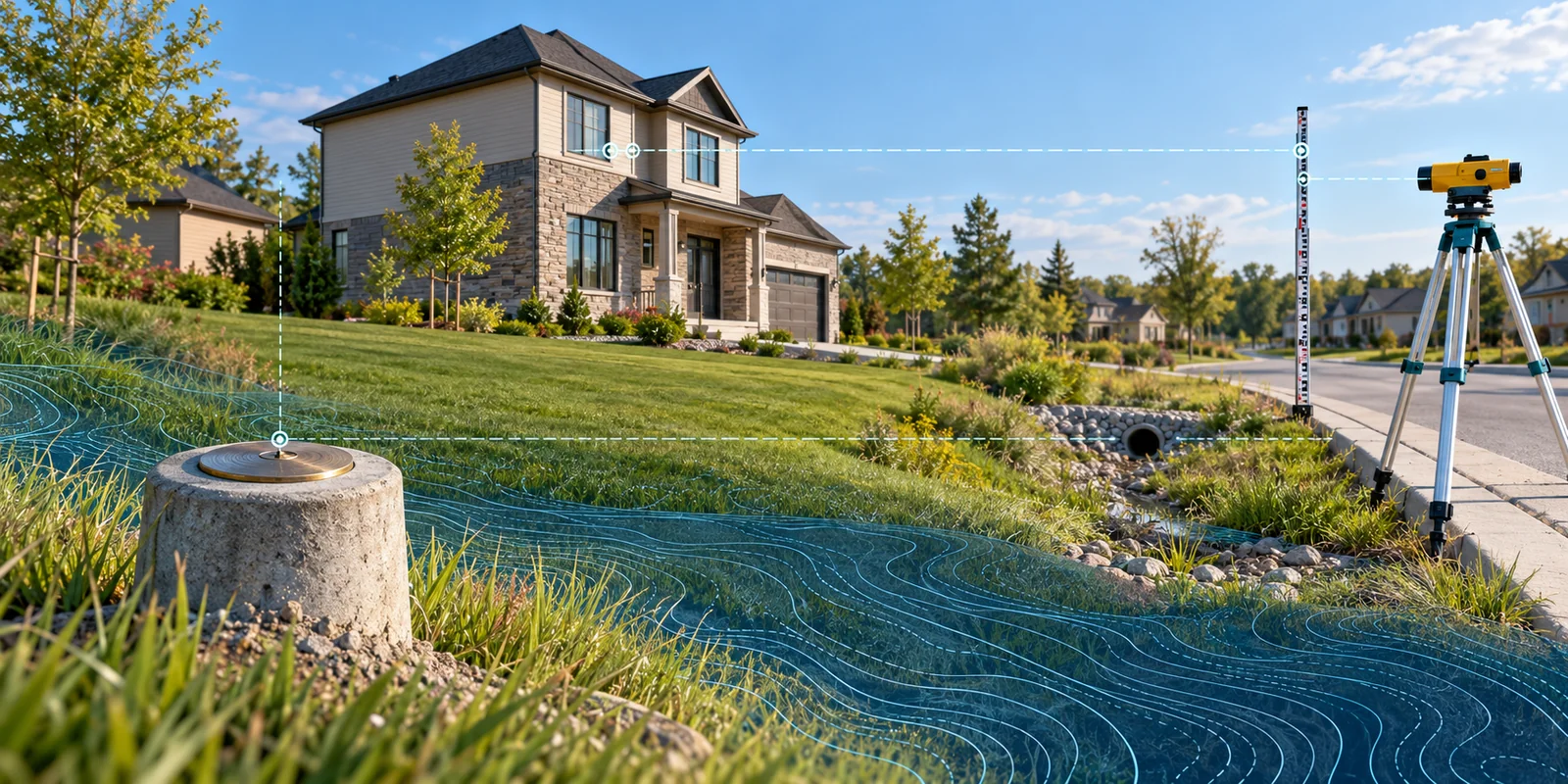
Grading plan benchmarks connect the elevations on a drawing to identifiable reference points on site. The elevation datum defines what those numbers mean. Confirming both helps the survey, building design, drainage plan and construction layout use a consistent vertical reference.
A drawing can show sensible slopes and still use the wrong starting elevation. Likewise, two plans can show different numbers for the same floor without describing different physical heights. The missing information may be the relationship between their reference systems.
This guide explains how to recognize that issue before design decisions depend on it. It focuses on elevation coordination, rather than providing a field-survey procedure or a universal municipal checklist. Your survey professional and grading designer must confirm the reference, required accuracy and project-specific requirements.
Key Takeaways on Grading Benchmarks
- A benchmark is a reference point; a datum is the reference system for its elevation.
- Relative building levels need a documented relationship to the grading plan’s vertical reference.
- CGVD28, CGVD2013 and GNSS ellipsoidal heights are not interchangeable labels.
- Resolve inconsistent references before relying on floor levels, drainage outlets or construction stakes.
What Are Grading Plan Benchmarks?
A grading benchmark is an identifiable point with an assigned elevation that the project team uses as a vertical reference. Its description should allow the appropriate survey professional to locate the intended point, rather than a nearby surface that happens to look similar.
For example, a note might identify a particular survey monument and the reference used for its published height. A project may also use a temporary benchmark, often abbreviated TBM. Its usefulness depends on its established relationship to the project’s control and its continued suitability.
The benchmark is not automatically the lowest part of the property. Nor does it necessarily identify a property corner. A boundary marker, control monument and grading benchmark serve different purposes, even where a professionally documented point can support more than one purpose.
How an elevation datum differs from a benchmark
An elevation datum provides the reference against which a height is expressed. The benchmark helps make that reference accessible through a particular point. Naming only the point, or only the elevation datum, can leave an incomplete record.
Think of a building level as a statement with two parts: the height value and the system behind it. “102.40 metres” is incomplete when the next drawing uses a different origin. Add the datum, source and relevant reference information before comparing the numbers.
This distinction also explains why moving a label in CAD cannot resolve a survey discrepancy. The design team needs evidence about the elevations, not merely a cleaner-looking drawing.
Relative levels can be useful without being geodetic
An architectural drawing may assign the ground floor a convenient value such as 100.000 or 0.000. Other levels then describe height differences from that origin. This can be entirely useful for coordinating the building’s internal geometry.
However, an assumed floor level does not identify its elevation in a municipal or national height system. Before connecting the building to a grading design, document which physical surface the reference describes and its corresponding project elevation.
A relationship between two drawing systems is not permission to change the actual building height. First distinguish a numerical relabelling from a physical design revision. Then update the affected drawings and schedules through the responsible designers.
Geodetic Elevation Datums: CGVD28 and CGVD2013
Canadian documents may identify CGVD28 or CGVD2013 as the vertical datum. Natural Resources Canada describes CGVD2013 as Canada’s official height reference system, adopted in 2015. It continues publishing older-system heights to support the transition. These systems are different, despite both being associated with mean-sea-level heights. See NRCan’s explanation of the Canadian Spatial Reference System.
Consequently, a drawing labelled “geodetic” still needs enough information to identify the intended system. Preserve the survey’s complete datum wording, including relevant adjustment information, rather than shortening it to an ambiguous note.
Do not assume that the newer national system automatically governs every municipal submission or existing approved design. The project team must confirm the receiving authority’s requirements and the reference of the information being combined. An existing drawing’s age alone cannot establish its elevation datum.
Why there is no universal conversion number
Do not add a remembered offset to every elevation in Ontario. A conversion must match the source system, destination system, location and appropriate method. NRCan directs users to its vertical datum transformation resources, including GPS·H conversion models.
In practice, retain a short conversion record with the drawing package. Identify the original data, who assessed it, the method used and the resulting reference. Keep the original files so a later reviewer can follow the decision.
A conversion also cannot recover detail that the original survey never measured. If the available information omits a critical threshold or drainage outlet, changing the datum does not supply that missing observation.
A GPS height is not automatically a grading elevation
GNSS equipment can provide ellipsoidal heights, referenced to a mathematical representation of the Earth. Grading work needs heights in the intended project system. NRCan’s GPS·H tool documentation explains converting ellipsoidal and orthometric heights through suitable geoid models.
The equipment name therefore does not establish the final elevation datum. Ask what the delivered values represent, which reference frame and model apply, and whether relevant epoch information has been recorded. A professional survey workflow must also address field conditions and the required accuracy.
For an owner, the useful question is simple: “Can the survey provider confirm that these elevations match the reference required for our grading design?” A phone’s elevation reading is not adequate evidence for resolving a disagreement between engineering drawings.
PEO Certificate of Authorization
Elmid Design Inc. provides engineering and design consulting for residential, commercial and land development projects in Toronto, the Greater Toronto Area and surrounding Ontario communities. Grading work brings together survey information, proposed building levels and drainage design so the project team can review them as a coordinated package.
Elmid Design Inc. holds an active Certificate of Authorization from Professional Engineers Ontario to offer professional engineering services to the public. The official PEO directory provides company registration information. This authorization does not replace municipal review or guarantee project approval.
What to Request with Grading Plan Benchmarks
Start the survey discussion before treating a preliminary building elevation as fixed. Explain the proposed work, intended application and the connections the grading design must make. A narrow survey limited to the footprint may not answer questions at the frontage or outlet.
The following is a practical coordination checklist, not a prescribed Ontario-wide survey specification. Agree on the actual scope with the survey professional and designer. Municipal requirements may add specific information.
- Reference: the vertical datum, units, benchmark identification and relevant source information.
- Coverage: the site features, boundaries, frontage and surrounding connections needed for design.
- Confidence: the intended accuracy, limitations, inaccessible areas and any uncertain observations.
- Delivery: survey date, drawing revision, digital-file format and a clear distinction between measured and other information.
Document grading benchmarks and their source
A useful benchmark description identifies the point, not just the object. A structure can have several edges, bolts or surfaces at different heights. The drawing note and survey records should remove doubt about which one carries the stated elevation.
Also retain the source of the assigned value. A published benchmark, a transferred site reference and an assumed architectural origin are not the same kind of evidence. If an older note is incomplete, ask the survey provider to clarify it rather than copying it into a new drawing.
Photographs can help communicate location and condition. However, they do not establish the benchmark’s elevation or prove that it has remained stable. Keep photographs as supporting records, not substitutes for the professional control assessment.
Check the reliability of site benchmarks
The Association of Ontario Land Surveyors’ Topographic Surveys Guide emphasizes complete reference-system descriptions and redundant control to detect movement or errors. It also distinguishes the precision shown in a result from its actual accuracy.
Accordingly, several decimal places should not be read as a promise of matching field accuracy. The project team should understand whether the information is fit for the intended decision. A broad terrain assessment and a constrained doorway connection can demand different survey detail.
Ask the survey professional to identify limitations plainly. Meanwhile, the designer should identify locations where missing or uncertain information prevents a dependable design decision. This allows further field work to target the unresolved issue.
Send site benchmarks and the elevation datum with digital files
PDF notes can become separated from the CAD file or surface model that a designer imports. Therefore, send the reference information with every technical file, not only in the email that first delivered the survey. A clear file name helps, but it cannot replace the actual survey notes.
Check units at import. A drawing can display familiar-looking labels while its model uses a different unit setting. Also distinguish a point’s stored height from a text annotation placed beside it. Editing the annotation alone may leave the underlying model unchanged.
For grading plan benchmarks, this creates a practical handoff test: can another authorized team member identify the reference without guessing? They should be able to locate the source note, identify the intended elevation datum and trace the data to its issue date.
Before issuing the grading design, compare selected critical labels with the information driving the model. Review the resulting PDF too. This is especially important after an import, conversion or reference update, when a drawing can retain stale text despite a changed surface.
Coordinate the Elevation Datum Across Drawings
Check the vertical reference whenever information passes between disciplines. The architectural plan, grading drawing, servicing profile and landscape layout may all describe the same entrance. They need a documented relationship, even when their preferred labels differ.
Create a short coordination schedule for critical levels. It can identify the physical surface, the value on each relevant drawing and the relationship between references. Include the source revision so the schedule does not become an undated second set of instructions.
Finished floors, thresholds and foundation levels
First confirm what each abbreviation means. A finished floor, top of structural slab, door threshold and top of foundation wall describe different surfaces. Even matching numbers can be misleading if the labels refer to different parts of the building.
For example, a proposed floor finish may sit above the structural slab. Changing that assembly can affect the relationship with an entrance landing. The building designer and grading designer should resolve the intended interface rather than treating the two labels as interchangeable.
Keep existing and proposed levels distinct as well. An existing house floor can be a useful observed constraint, but a proposed replacement floor is a design decision. State which value the survey measured and which value the design proposes.
Swales, receiving outlets and servicing profiles
Surface drainage depends on connected elevations, not an isolated arrow. Check the route from the proposed ground surface to the intended receiving point. A consistent elevation datum helps the designer compare the full route without introducing an artificial step between datasets.
Similarly, a catchbasin rim and a pipe invert describe different elevations. The invert is the internal bottom of the pipe; the rim describes the surface opening. Do not compare them as though they represent the same physical point.
Where stormwater storage or a regulated water level affects the design, identify the reference attached to that information too. Resolve any mismatch with the responsible specialist or authority before comparing it with building levels or an overflow route.
Boundary interfaces and neighbouring features
The property line is a location, not a proposed elevation. Nevertheless, the design needs reliable information about how the ground meets adjacent land. Relevant features can include a shared swale, retaining interface, driveway edge or neighbouring entrance.
Do not fill a survey gap by assuming that a fence base represents the ground on both sides. Nor should a designer extend a smooth digital surface across an unmeasured wall or grade break without qualification.
Coordinate required observations and access through the appropriate professionals. If a critical connection remains uncertain, show that limitation and resolve it before presenting the affected design as settled.
Reading Spot Elevations from Grading Plan Benchmarks
A spot elevation describes a particular point. A contour connects locations represented at the same elevation. Neither tells the whole grading story without the reference, feature description and surrounding geometry.
For example, a pair of levels may show a fall across a driveway. Yet the drawing still needs the relevant horizontal distance and intervening grade changes to explain the profile. An isolated difference cannot establish that the entire route drains as intended.
Check what the digital surface represents
A digital terrain surface connects observations through an interpreted model. Where a wall, curb or swale interrupts the ground, the model needs to represent that break appropriately. Otherwise, a smooth-looking surface can conceal an important local condition.
Ask whether the point describes bare ground, pavement, a structure or another feature. Vegetation and obstructions can also limit what was observed. The designer should understand these limitations before using the surface to set a constrained drainage interface.
Existing contours are not proposed grading instructions. Likewise, an existing spot level should not silently become a proposed elevation because it sits near new work. Use a clear legend and check that the PDF preserves the intended distinction.
Use level differences for the right question
Once two points use a compatible reference, their difference can help explain a slope or vertical separation. However, that arithmetic does not assess every design requirement. A doorway connection can also involve accessibility, waterproofing and building-detail coordination.
Similarly, a swale may have a continuous fall but still need hydraulic assessment or an appropriate outlet. Reference consistency supports the engineering analysis; it does not replace it. Keep those separate questions visible during review.
When Grading Plan Benchmarks or Elevations Disagree
Pause the affected decision and investigate the discrepancy. Do not simply choose the newer drawing, average two elevations or move the proposed building until the numbers look consistent. Each approach can hide the cause.
Begin by checking units, elevation datum notes, source revisions and physical point descriptions. Next, ask whether one value represents a different surface or an earlier design. Only then can the team decide whether further measurement, a documented conversion or a design revision is needed.
Look for patterns without treating them as proof
A similar difference at several points may suggest a reference offset. By contrast, a disagreement at one point may suggest a changed feature, identification issue or observation problem. These patterns help frame questions, but they do not establish the answer.
Record the comparison in a small issue log: location, competing values, source files, responsible reviewer and required resolution. That record is more useful than a vague email saying that the survey is “off.”
Once the responsible professional resolves the issue, update the affected information together. Otherwise, an old foundation level can remain on one sheet after the grading drawing has been corrected. Check linked schedules and model exports as well as the visible plan.
The resolution should also explain whether earlier decisions remain valid. If the issue was only a documented label difference, the physical design may be unchanged. If a new observation changes the available drainage fall, further design review may follow. Keep the reason for the revision alongside the corrected value.
Not sure which service you need?
Elmid Design Inc. helps owners coordinate engineering and design for building and land development projects. A proposed entrance or addition may need building permit design alongside grading. A larger site may also need site servicing drawings or a stormwater management report.
Share the proposed work and available survey so the relevant scope can be identified. View all engineering services.
Municipal Checks for Grading Plan Benchmarks
Municipal instructions are application-specific. Confirm the current checklist for the property and submission type instead of treating one city’s wording as an Ontario standard. These examples show why benchmark and elevation notes deserve an early review.
Toronto: identify benchmarks and building levels
Toronto’s Site Grading Plan terms of reference for Site Plan Control call for benchmarks with location descriptions and geodetic elevations. They also identify building levels and surrounding grading information. Read the City’s current application-support requirements in the context of the applicable submission.
The coordination takeaway is to connect the survey reference with the proposed building and adjacent site information. For broader local context, see our Toronto grading plan resource. It does not replace the City’s project-specific direction.
Oakville: use the identified municipal reference
Oakville’s residential infill guide calls for a geodetic survey datum derived from Town benchmarks and identification of the benchmarks on the grading plan. Its checklist also addresses survey currency and building siting elevations. Consult the Grading and Servicing Plan Guide for Residential Infill Developments.
Confirm which current instructions govern the proposed work. A note copied from a different property does not identify the control used for your survey. Our Oakville grading resource provides related service context.
Mississauga: check the current grading requirements
Mississauga’s October 2025 terms of reference require existing and proposed elevations to describe the site and its connections with adjoining land. They also address building entrances, drainage and survey information. Use the current Grading Plan terms of reference, rather than relying only on an older downloaded checklist.
Ask the project team to confirm the required vertical reference and control information for the application. Do not infer a particular elevation datum solely from a drawing’s municipal location. See our Mississauga grading resource for related design guidance.
Protect Grading Plan Benchmarks Through Construction
Grading plan benchmarks must remain meaningful after design. Before site work affects the reference, establish who will verify it, communicate changes and provide any replacement control. A note in a drawing cannot protect a point that excavation or demolition removes.
Keep the survey professional, designer and construction team informed when access changes or a reference appears disturbed. Do not transfer an elevation to a convenient object without the responsible survey process and documentation.
Confirm site benchmarks and the drawing issue before layout
A verified benchmark does not make an outdated drawing suitable for construction. Confirm the applicable issue, approved changes and coordination instructions before using the design for layout. A preliminary floor level can survive in a contractor’s saved PDF long after the design changes.
Conversely, a current drawing does not prove that field control is undisturbed. The document check and field-reference check address separate risks. Both belong in the project’s agreed construction coordination process.
After a significant level change, identify the consequences rather than revising only one label. Entrances, drainage routes, retaining interfaces and service connections may all need review. The responsible designers should determine which drawings and approvals the change affects.
Compare as-built information on a compatible basis
As-built elevations are useful only when their source and reference are clear enough for comparison. Record the survey date, relevant limitations and the drawing issue used for the assessment. Also distinguish an observed surface from a value carried forward from another record.
If the completed work differs from the design, first establish whether the difference is physical or comes from inconsistent references. Then the responsible professional can assess the actual condition and the applicable municipal close-out requirements.
This does not create an automatic acceptance tolerance. The required assessment depends on the project, the approved design, the survey evidence and the reviewing authority.
Grading Plan Benchmarks: A Worked Coordination Example
Consider a hypothetical residential addition. The architectural drawings use a relative finished-floor level of 100.000 metres. The survey and civil design use a separately confirmed project elevation datum. This example illustrates reference coordination only; the values are not design recommendations.
Suppose the responsible project team establishes that the same finished-floor surface is 214.250 metres in the civil reference. The difference between the two labels is therefore 114.250 metres. Both labels describe one physical surface, not two floors at different heights.
One surface, two documented labels
- Architectural finished-floor reference
- 100.000 m
- Corresponding civil finished-floor elevation
- 214.250 m
- Documented relationship for this example
- Civil elevation = architectural level + 114.250 m
This relationship is specific to the hypothetical drawing origins. It is not a CGVD28-to-CGVD2013 conversion.
A landing at architectural level 99.850 would therefore correspond to civil elevation 214.100, provided both drawings describe the same surface and unchanged design. The 0.150-metre difference from the floor remains the same in either reference.
Now suppose a revised architectural sheet raises the actual finished floor by 0.100 metres. That is a design change, not a new datum. The team must review its effects on the entrance and surrounding grading rather than quietly changing the reference relationship.
The example also shows why the surface description matters. If one sheet labels the top of structural slab and the other labels finished floor, the simple comparison is incomplete. Confirm the floor assembly and intended surface before using either value.
How Elmid Design Inc. Can Help with Elevation Coordination
Elmid Design Inc. prepares site grading and drainage plans that coordinate proposed spot elevations, drainage routes and building-level interfaces. For a benchmark-related assignment, the work can include reviewing the supplied survey reference, identifying inconsistent drawing levels and documenting the elevation basis used in the grading design.
The scope depends on the property and available evidence. Survey control, boundary information and additional field measurements remain matters for the appropriately retained survey professional. Elmid Design Inc. coordinates engineering requirements with that information rather than presenting an assumed datum as a verified survey result.
A useful starting package includes the property address, proposed work, current survey, available architectural drawings and municipal comments. Include previous grading approvals where available, but identify them as records rather than assuming that they describe today’s ground conditions.
A relevant example from the public project portfolio
For a proposed replacement dwelling in Burlington, Elmid Design Inc. prepared grading and drainage plans that coordinated building elevations, driveway and yard grades, drainage swales, curb details and site-specific sediment fencing. The public project portfolio records that design scope.
The example illustrates the different site and building elements a grading package must coordinate. It does not establish a particular datum-conversion method or claim a construction outcome. Those conclusions would require separate project evidence.
For your project, the aim is a traceable drawing package: clear reference notes, coordinated critical elevations and identified questions that need resolution. This gives owners and other designers a practical basis for the next decision.
Frequently Asked Questions about Grading Plan Benchmarks
Are grading benchmarks the same as property boundary markers?
No. A benchmark provides a vertical reference, while a boundary marker serves a different surveying purpose. Do not assume that an iron bar, stake or monument carries a usable grading elevation. Ask the survey professional to identify the intended point and its documented role.
Can an assumed elevation datum be used on a grading plan?
Only where it is suitable for the project and accepted under the applicable requirements. Relative levels can help coordinate a building, but municipal connections may require a specified geodetic reference. Confirm this before completing the survey or fixing proposed floor levels.
Does “geodetic” mean CGVD2013?
Not necessarily. The word alone does not identify the complete vertical reference. Read the full survey note and confirm the actual datum, relevant adjustment and source. Do not replace an older label merely because a newer national height system exists.
Can I convert CGVD28 to CGVD2013 by adding one offset?
Do not use an unverified general offset. The conversion must be appropriate to the source information, location and intended destination system. Have the responsible survey professional confirm the method and document it. The worked architectural example above is a different situation.
What if site benchmarks have been removed?
Tell the survey professional and project team before relying on replacement control. The appropriate response depends on the remaining control and records. Do not assign the old elevation to a nearby object or assume that construction can continue from memory.
Will a new elevation datum fix an incorrect drainage slope?
No. Changing the reference does not repair the physical ground or make an unsuitable design work. First resolve any reference mismatch. Then assess the actual level differences, drainage path and receiving connection using reliable, compatible information.
Who coordinates the survey and grading elevations?
The project team should assign that responsibility explicitly. Survey providers establish and document the survey reference; grading designers use verified information for the engineering design. Building and other designers must coordinate their own levels with that agreed basis.
Official References and Further Reading
The technical discussion draws on the linked NRCan height-reference and transformation resources, AOLS topographic guidance, and current municipal documents reviewed in October 2026. These sources serve different purposes: national reference systems, professional surveying guidance and local application requirements. Confirm the documents that apply to your property when the design begins.
Geographic Locations That We Service:
Our Licensed Professional Engineers specializing in Engineered Site Grading Plans provide professional engineering and design services for site grading plans, lot grading, erosion and sediment control plans, and drainage plans to support applicable site plan approval and building permit applications in Ontario.
We provide engineering services across a wide range of municipalities, each with its own requirements and review processes.
Toronto and Surrounding Areas
We provide engineering services in Toronto and provide grading engineering resources through our Toronto grading plan page.
Our service area also includes Oshawa, Pickering with our Pickering grading plan resources, and Clarington.
We also provide engineering services in Ajax through our Ajax grading plan resources, Whitby, Brock, Scugog, and Uxbridge, including our Uxbridge grading plan resources.
Halton Region
Within Halton Region, we provide engineering services in Burlington, including projects requiring Burlington grading plans.
We also provide engineering services in Halton Hills, supported by our Halton Hills grading plan resources.
Our service area also includes Milton and Oakville, including our Oakville grading plan resources.
Peel Region
Within Peel Region, we provide engineering services in Brampton, including projects requiring Brampton grading plans.
We also provide engineering services in Mississauga through our Mississauga grading plan resources and Caledon through our Caledon grading plan resources.
York Region
Within York Region, we provide engineering services in Vaughan and provide information about Vaughan grading plans.
We also provide engineering services in Aurora through our Aurora grading plan resources and East Gwillimbury through our East Gwillimbury grading plan resources.
Additional service areas include Georgina with our Georgina grading plan resources, Markham with our Markham grading plan resources, and Newmarket with our Newmarket grading plan resources.
We also provide engineering services in Richmond Hill with our Richmond Hill grading plan resources, Whitchurch-Stouffville through our Whitchurch-Stouffville grading plan resources, and King through our King grading plan resources.
Our service area also includes Bradford West Gwillimbury.
Other Southern Ontario Cities and Towns
We provide engineering services in many additional Southern Ontario communities, including Hamilton, St. Catharines, Niagara-on-the-Lake, Brant, Cambridge, Kitchener, Waterloo, and Woodstock.
We also provide engineering services in Guelph, Centre Wellington, Shelburne, Orangeville, New Tecumseth, Essa, Collingwood, Wasaga Beach, and Barrie, including our Barrie grading plan resources.
Additional service areas include Midland, Orillia with our Orillia grading plan resources, Ramara, Minden Hills, North Kawartha, Kawartha Lakes, Peterborough, Selwyn, and Brighton.