A site plan drawing for a building permit shows how the proposed work fits on the lot, including property lines, building locations, setbacks and other information the municipality needs.
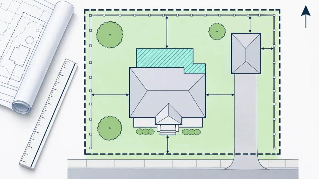
The drawing above is a general example, not a client project, and has no dimensions. A real submission needs project-specific measurements, zoning figures and notes.
In Ontario, the municipality uses the site plan drawing to check zoning and siting before it issues a building permit. This guide explains what it shows, who prepares it and how it differs from a survey, a grading plan and Site Plan Approval.
What is a site plan drawing for a building permit?
A site plan drawing for a building permit is a scaled plan of your whole lot that places the proposed work on it. It shows where the house, addition, garage or garden suite sits, how far it is from each lot line, and how much of the lot is covered.
You will also see it called a plot plan, a lot plan or an architectural site plan.
What does a residential site plan drawing show?
A residential site plan drawing shows the lot boundary from a survey, every existing and proposed structure and the setback to each lot line. It also shows zoning statistics, the driveway and landscaping, easements, and grades or a reference to a grading plan. The exact list comes from your municipality’s checklist.
The City of Toronto gives a clear example. Its pre-approved garden and laneway suite page (City of Toronto, accessed November 9, 2026) asks for a survey or site plan showing property lines, lot area and easements. It must be referenced to a current survey.
A typical residential drawing includes:
- Lot lines and dimensions from the survey, with a north arrow, scale and the municipal address.
- Existing structures (house, garage, shed, deck, pool) labelled to remain or to be removed.
- Proposed work with overall dimensions, clearly distinguished from what is already there.
- Setbacks from the building to the front, side and rear lot lines, and to neighbouring buildings where the checklist asks for it.
- Zoning statistics: lot area, building area or gross floor area, lot coverage and height, shown as permitted and proposed.
- Driveway, parking and walkways with dimensions, plus hard and soft landscaping.
- Easements and rights-of-way registered on title and shown on the survey.
- Trees on the lot and close to it, where a tree by-law or tree declaration applies.
- Grades (existing and proposed elevations) or a note that refers to a separate grading plan.
- Services such as water, sewer and storm connections, or a rural septic system, when the municipality asks.
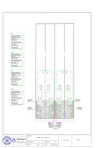
A site plan sample by Elmid
A site plan Elmid Design Inc. prepared for two adjoining residential lots in Ontario, shown as a small thumbnail of the full sheet.
Why does the building department need a site plan drawing?
The building department needs the drawing because a permit can only be issued for work that complies with the Building Code and other applicable law, including zoning. The site plan is how the examiner checks setbacks, coverage, height and siting without visiting the property.
Toronto’s page cited above says a permit may only be issued where the construction complies with the Building Code Act, 1992, the Building Code, zoning and other applicable law. Even a pre-approved design is still reviewed for its placement on the lot.
The current Code is the 2024 Ontario Building Code, O. Reg. 163/24, in effect since January 1, 2025. The Province’s 2024 Building Code Compendium (ontario.ca, updated October 20, 2026, accessed November 9, 2026) lists later amendments, so work from the current version.
Does every permit need a new survey?
Not automatically. What every site plan drawing needs is survey information that is accurate and current enough for the project. Whether an existing survey is acceptable, or must be updated, depends on the municipality and on what has changed on the lot since it was prepared.
A survey is usually worth updating when:
- structures have been built, removed or enlarged since it was prepared, such as a deck, shed, pool or driveway widening;
- the proposed work is close to a lot line, so small errors could change a setback;
- grades matter for height or drainage and the survey shows few or no elevations.
Only an Ontario Land Surveyor can prepare or update a legal survey. If you are unsure whether yours is suitable, ask the building department before drafting starts.
Who can prepare a site plan drawing in Ontario?
The site plan drawing is usually prepared by whoever prepares the permit drawings: a qualified designer, an architect or a professional engineer, depending on the project. In some cases an exempt owner can prepare drawings for their own project.
Under the Building Code Act, certain designers must be qualified and registered with the Ministry of Municipal Affairs and Housing and hold a Building Code Identification Number (BCIN), as the Province’s building practitioner registration page explains (ontario.ca, accessed November 9, 2026).
Toronto’s Schedule 1 designer information form, described on the City’s pre-approved garden and laneway suite page cited above, shows how this works in one municipality. The City requires it for all designers except engineers and architects applying for any construction permit.
The right professional depends on the building, the scope and the municipality.
Elmid prepares site plan drawings as part of building permit drawings, using the survey you provide. We do not prepare legal surveys or stake lot lines.
How is it different from a survey, a grading plan and Site Plan Approval?
A survey records legal boundaries and existing conditions. A site plan drawing places the proposed work on that survey for the building permit. A grading plan shows elevations and drainage. Site Plan Approval is a separate municipal planning approval, not a drawing on its own.
| Document | Prepared by | What it is for |
|---|---|---|
| Survey (plan of survey) | Ontario Land Surveyor | Legal lot boundaries, dimensions, easements and existing features. The base for the other drawings. |
| Site plan drawing for a building permit | Permit designer, architect or engineer, depending on the project | Places the proposed work on the lot with setbacks, coverage and zoning statistics for zoning and Code review. |
| Grading plan | Often an engineer; the municipality sets who may prepare it | Existing and proposed elevations, drainage directions and how runoff leaves the lot. |
| Site Plan Approval (site plan control) | Applicant’s consultant team; approved by the municipality | A planning approval under section 41 of the Planning Act, where a municipality has designated a site plan control area. |
When do I also need a grading plan?
You need a grading plan when your municipality asks for one, which is common for new houses, additions, garden suites and work that changes ground levels or drainage. Check the permit checklist or ask the building department before you apply.
For example, Mississauga’s page on pre-approved garden suite plans (City of Mississauga, accessed November 9, 2026) says a site plan and a grading plan are still required.
Mississauga’s site plan must also show setbacks, lot coverage, fire department access and water and sanitary servicing. Toronto’s pre-approved garden and laneway suite page also asks for a lot grading plan.
Elmid prepares site grading plans and coordinates them with the site plan drawing; see our guide to lot grading plan requirements.
Does site plan control apply to a small residential project?
Usually not. Subsection 41 (1.2) of the Planning Act (e-Laws, accessed November 9, 2026) covers residential building on a parcel that will contain no more than 10 residential units. Such building is generally not “development” for site plan control.
The exemption does not apply if the parcel includes any land in a prescribed area. Site plan control also applies only where the municipality has designated a site plan control area by by-law.
The prescribed areas are set out in O. Reg. 254/23 (e-Laws, no amendments, accessed November 9, 2026). They include land within 300 metres of a railway line, and land within 120 metres of a wetland, the Great Lakes–St. Lawrence River System shoreline, an inland lake, or certain river or stream valleys.
The regulation excludes some railway lines, such as discontinued or abandoned lines and lines used only by an urban rail transit system. These distances decide whether site plan control can apply; they are not building setbacks.
Toronto’s parallel provision is section 114 of the City of Toronto Act, 2006. If site plan control applies, see our Site Plan Approval service.
Since January 22, 2026, O. Reg. 10/26 has named professional engineering as a prescribed profession under subsection 41 (3.5.1) of the Planning Act. Information or material that a municipality requires for a complete site plan application is deemed to meet that requirement if it is prepared by a person authorized to practise professional engineering. That does not mean the application is approved.
Separately, the Province’s ERO 026-0310 notice, posted March 30, 2026 (comment period closed May 14, 2026), sought comment on reforming site plan control. On November 9, 2026 it was still a proposal, so the current rules above apply.
How does a site plan drawing move through municipal review?
A site plan drawing is reviewed as part of the building permit application, not on its own. The sequence below is typical for a residential permit; your municipality’s process and timing may differ. For the full City of Toronto process, see our Toronto building permit guide.
- Pre-application check: confirm the checklist, zoning, survey and any other approvals needed.
- Drafting: the designer prepares the site plan drawing with the rest of the permit set.
- Submission: the application, drawings and forms are submitted and checked for completeness.
- Zoning and Code review: examiners check siting, setbacks, coverage, height and Code matters.
- Comments and resubmission: if information is missing or inconsistent, the drawings are revised and resubmitted.
- Permit decision: the permit is issued once the municipality is satisfied the work complies.
No designer can promise the outcome or timing of that review; a complete, consistent drawing simply leaves fewer questions.
Why do site plan drawings get examiner comments?
Most comments come from missing or inconsistent information: an outdated survey, setbacks not dimensioned to every lot line, coverage figures that do not match, or existing structures left off. Clear labels and consistent figures can reduce resubmissions.
Check for these gaps before you submit:
- Setbacks are shown to some lot lines but not all, or are measured to the wrong part of the building.
- The zoning summary uses different areas from the floor plans.
- Easements on title are not shown, so the examiner cannot confirm the work stays clear of them.
- Grades are missing, so height cannot be confirmed.
- The site plan and grading plan show different building footprints or driveway layouts.
What does a site plan drawing look like for a rear addition?
For a rear addition, the drawing shows the existing house, the addition clearly marked as proposed, and the distances that change. This hypothetical example uses the hatched addition in the diagram above, without dimensions, because every lot and by-law differs.
The drawing would typically:
- hatch or shade the addition so it cannot be confused with the existing house;
- dimension the new rear setback, and the side setbacks if the addition is wider than the house;
- update the zoning summary with the new building area and lot coverage, permitted and proposed;
- show grades around the addition, or refer to a grading plan if one is required.
What should I send Elmid to prepare a site plan drawing?
Send a current survey of the property, your proposed drawings or sketches, the municipality’s checklist or any examiner comments, and the property address. With those we can confirm scope and tell you what else is needed, such as a grading plan or tree information.
- Survey: the most recent plan of survey, in PDF and, if you have it, CAD format.
- Proposed drawings: floor plans, elevations or a dimensioned sketch.
- Municipal checklist or comments: the permit checklist you are working from, or the examiner’s letter if you already applied.
- Address and municipality: so we can review the zoning by-law, any past minor variances and local drawing standards.
- Other reports if available: arborist reports, septic records for rural lots, or earlier approvals for the property.
Frequently asked questions
Is a plot plan the same as a site plan?
For a residential building permit, yes in practice. Plot plan, lot plan and site plan drawing all name the sheet that places the proposed work on the lot. Site Plan Approval is different: a separate municipal planning process with its own application and review.
Can I submit my survey as the site plan?
Sometimes, but rarely on its own. Toronto, for example, accepts a survey or a site plan referenced to a current survey, yet the drawing must still show the proposed work, setbacks and zoning statistics. Check your municipality’s checklist before relying on the survey alone.
Where can I find an existing survey or site plan for my house?
In Toronto, site plans and surveys from earlier permits can be requested through the City’s building records request (City of Toronto, accessed November 9, 2026). The Ontario Land Surveyor who prepared a survey may provide a copy, often with a release of liability. The Association of Ontario Land Surveyors notes that old plans may be out of date.
Does Elmid prepare legal surveys?
No. Elmid Design Inc. is an engineering consultant; legal surveys are prepared by an Ontario Land Surveyor. We use the survey you provide to prepare the site plan, grading plan and other permit drawings within an agreed scope. Without suitable survey information, engage a surveyor first.
Can I draw my own site plan for a building permit?
In some cases, yes. An owner who is exempt from the Building Code Act’s designer qualification requirements can prepare drawings for their own project. In Toronto, the owner states the reason for the exemption on the Schedule 1 form. The municipality still decides whether the drawing is complete and acceptable, so check its checklist first.
Do I need Site Plan Approval for a house addition?
Usually not. Under the Planning Act, most residential projects of 10 or fewer units are outside site plan control. The exception is a parcel that includes land in a prescribed area, such as land near certain railway lines, wetlands or shorelines. Confirm with your municipality’s planning department.
Do I need a grading plan as well as a site plan?
Often, yes. Many municipalities ask for a grading plan for new houses, additions and garden suites, especially where ground levels or drainage change. Toronto and Mississauga both list one for pre-approved garden suite permits. Your municipality’s permit checklist confirms what your project needs.
How much does a site plan drawing cost?
Cost depends on the site and the scope, for example whether a grading plan is needed or an Ontario Land Surveyor must first update the survey. Send us your survey, proposed drawings and address to request a proposal; we confirm the scope in writing before work starts.
Areas we serve
Elmid Design Inc. prepares building permit drawings, site grading plans and Site Plan Approval submissions for projects in Toronto and the Greater Toronto Area, including York, Peel, Halton and Durham regions. We also work in other Ontario municipalities, depending on project scope and availability.
Related articles
- Walkout basement drainage grading plan in Ontario
- Toronto building permit guide: applications, drawings and review
- Permit drawings for home additions in Ontario
Sources
- Ontario, Planning Act, R.S.O. 1990, c. P.13, section 41 (e-Laws consolidation from July 1, 2026), accessed November 9, 2026.
- Ontario, O. Reg. 254/23: Prescribed Areas – Section 41 of the Act (consolidation from August 9, 2023; no amendments), accessed November 9, 2026.
- Ontario, O. Reg. 10/26: Site Plan Control (in force January 22, 2026; no amendments), accessed November 9, 2026.
- Environmental Registry of Ontario, ERO 026-0310: Proposal to reform site plan control, posted March 30, 2026, comment period closed May 14, 2026, status Proposal, accessed November 9, 2026.
- Ontario, 2024 Building Code Compendium, Preface, updated October 20, 2026, accessed November 9, 2026.
- Ontario, Become a registered building practitioner, updated November 3, 2026, accessed November 9, 2026.
- City of Toronto, Pre-Approved Garden and Laneway Suite Building Plans, modified October 30, 2026, accessed November 9, 2026.
- City of Mississauga, Pre-approved garden suite plans, accessed November 9, 2026.
- City of Toronto, Request Building Records, modified January 8, 2026, accessed November 9, 2026.
- Association of Ontario Land Surveyors, FAQs, accessed November 9, 2026.
This article is general information, not advice for a specific property. Requirements vary by municipality and change over time; confirm current requirements with your municipality before you apply.